ICE AGE TRAIL (Part One) - 2020
- Apr 17, 2022
- 70 min read

1200 Miles to Kilimanjaro ... the group was sad when we needed to postpone the trip to Tanzania that had been scheduled for September 2020. But finding the Ice Age Trail was a great break from COVID; it further honed our hiking skills and made our group even more cohesive. After Jeff's heart attack in March 2020, he started logging his walking miles in a spreadsheet. By the time we went to Tanzania in September 2021, we'd walked over 1200 miles and felt great. Incidentally, the IAT will be about 1200 miles when we're finished with it, but this account is just of our first 681 miles!
About the Ice Age Trail (IAT) - from the Ice Age Trail Alliance
The Ice Age National Scenic Trail is a thousand+-mile footpath that highlights glacial landscape features as it travels through some of the state’s most beautiful natural areas. The Trail is entirely within Wisconsin and is one of only eleven National Scenic Trails.
But the Ice Age Trail is more than a path through the woods. More than 2.3 million people use the Ice Age Trail each year to hike and snowshoe, to backpack, to disconnect and reconnect.
Behind the scenes, a vibrant community of volunteers across the state work to build and maintain the Trail, making it one of the country’s best hiking experiences.
Ice Age Trail Facts:
The Trail is managed by a partnership among the National Park Service, the Wisconsin Department of Natural Resources and the Ice Age Trail Alliance.
The Ice Age Trail is open for hiking, backpacking and snowshoeing. Many segments support cross-country skiing, too.
The Trail is not yet complete. More than 600 miles are yellow-blazed Ice Age Trail segments, and more than 500 miles of unmarked connecting routes link the blazed segments. The entire route is about 1,200 miles long.
The Trail’s western terminus is in Interstate State Park in St. Croix Falls, Polk County. It overlooks the St. Croix River and our neighbors in Minnesota.
The Trail’s eastern terminus is in Potawatomi State Park in Sturgeon Bay, Door County.
The Ice Age Trail is built and maintained largely by volunteers.
Most of the blazed Ice Age Trail Segments fit hikers’ ideas of a traditional, off-road hiking experience. Some segments, however, lead hikers right down the main streets of Wisconsin communities. This is by design – the Ice Age Trail is meant to connect people and communities.
Thirteen municipalities (with more joining each year) have chosen recognition as an Ice Age Trail Community, underscoring the Trail’s positive economic impact, locally. Together, the Ice Age Trail Alliance and Trail Communities promote the unique qualities that make the Trail, and the community it travels through, a meaningful destination.
The Trail occasionally coincides with state bike trails – biking is allowed on these sections only. Horseback riding is not permitted. Motorized vehicles are not permitted (with the exception of just a few segments that share state multi-use trails).
The Ice Age Trail began in the 1950s as the dream of Milwaukeean Ray Zillmer, who had a vision of a long, linear park winding through Wisconsin along the glacier’s terminal moraine.
The Trail crosses over many ownership types, including private land, city parks, state parks, county forests and national forest.
The Trail travels through 30 counties.
One of the goals of the Ice Age Trail Alliance is to permanently protect the route of the Ice Age Trail. Every year, we purchase land with privately donated funds and grants from government partners to get closer to achieving this goal. The State of Wisconsin also acquires land for the Trail through its Knowles-Nelson Stewardship Program.
IAT Day One Saturday June 6, 2020: St Croix Falls to Centuria WI
A perfect day for the start of our Wisconsin adventure! Up early, some were out shuttling cars, while others checked out the new post-COVID breakfast bar at the hotel (everything’s prewrapped).
Quick drive to the park and we were hiking just after 7am, after Dan presented us with a kick-off poem and Gary read us the hiker’s prayer. So exciting to have made this happen - just 12 days from dream to reality.
The trail today went through some beautiful segments within the park, and then the town of St Croix Falls. I’m sure many locals don’t even know about these gems right in their backyard!
We quickly learned to scout for the yellow blazes marking the trail - some on posts, most are yellow markers nailed to the tree, or a yellow stripe painted on the tree. Only some slight confusion when a downed tree would abruptly block the path!

We wound through town on several different trails, sometimes connected just a block or two down the street. Once the trail opened out into the school grounds, then back into the woods then back to the school. We climbed a bit, walked through open meadows. We saw a tiny fawn there among the wild flowers, it stood and looked at us a bit and then laid down and we’d have never known it was there!
We hiked a section with large granite expanses, and dense beautiful forests. But we saw just 4 people on the trails - amazing!
About 11am we got to Lion’s Park, right on the river, where we took a packs off sit down lunch break. The park had pit toilets and should have had drinking water, but due to COVID we can’t count on those being turned on (this one wasn’t, but we all were carrying ample water today).
From there, the trail paralleled the river for just over 2 miles. It was a beautiful forest, with periodic views of the river. Lots of creeks running down to the river - fun to cross them with the stepping stones and glad to have my hiking sticks (guidebook said we may have to ford some of these in high water). Lots of deer prints in the mud on the trail, and we saw several deer. If we’d have stood still and watched I’m sure we’d have seen dozens.
Then it was out to the road to slog along on a 4-mile connector to the next trail segment. We passed the time chatting and took a few breaks, all of us (except perhaps Gary) feeling the effects of 10+ miles and the heat!
As we approached the tiny little town of Centuria, the Gandy Dancer trail crossed the road and we took that for our last mile to Centuria. It’s a crushed limestone multi-use trail that stretches from St Croix Falls to Superior. Tomorrow’s route will be entirely on that trail.
We arrived about 3pm, good to be done, get some fresh water and get the boots off!
We sat around for a bit, then hatched a plan to all drive back to St Croix Falls for an early dinner and the pick up the Knickmeier’s car at the park. We’d planned to stealth camp at the trail shelter tonight and it was too early to set up camp!
The restaurants are still figuring out how to reopen after being closed for 2+ months during the “Safer at Home” orders from the pandemic. Not a good mix for trying to eat dinner on a Saturday night in a tourist town. Striking out at a few places in St Croix Falls, we headed across the river to Taylor Falls MN, where downtown was crazy. There we found places were still closed, or at their 50% occupancy quota and we’d have to wait. We decided to go back to the Dalles where we ate Friday night, and ate out on their patio, with the smokers. Being in the madness sure messed with the mojo I’d developed being in the wilderness today. After tomorrow, I’m sure we’ll be further removed from this kind of madness!
Back to Centuria, we set up our tents on the short grass next to the pavilion with flush toilets and a drinking fountain (and a picnic table outside). The IAT has a “DCA” set up 0.1 miles down the trail, but we wanted to be closer to the amenities! A DCA is a Dispersed Camping Area for backpackers to use. You’re supposed to set up camp within site of the DCA sign. The DCAs are rustic though - no water, no toilet!
While it had been a gorgeous day, as we were sitting around our camp (on our picnic table), the weather began to shift - it became breezy and it clouded up quickly. About 7:45p we all retreated to our tents and the rain started shortly after that. Should sleep well after that kind of exercise today!!
Stats today: Apple Watch = 15.21 miles (map showed 14.3), 1626 ft elevation, 7 hours elapsed which includes break time, 1 Woodtick.
Segments today:
Pothole Trail
Horizon Rock Trail
Skyline Nature Trail
Hospital Esker
Blanding Woods
Florence Baker Riegel Memorial Park
Ray Zillmer Park
Mindy Creek
Wert Family Nature Preserve
Gandy Dancer State Trail
United - A Poem by Dan (AKA Hiker #7)
What keeps us united?
A tale to tell?
A love of nature?
To hike in concert?
To walk thru life?
Gary?
Perhaps…
Ah…
A love of friendship
A selfless humanhood
A restless energy
A desire to explore as one, not alone
…Of course
Our memories extensive
Our trips expensive
Till now…
Then came the virus
The Ice Age Trail
…wow right under our nose
Thank you, Gary
For a picture lets pose
IAT Day 2 - Sunday June 7, 2020
It stormed most of the night - rain and very windy. About 9 PM a siren went off, not exactly a tornado siren, but enough to freak me out for a bit. We realized this morning that it was probably was a curfew alert!
Everyone was a little creaky and moving slowly as they emerged from their tents. It was still drizzling and very windy, so we bagged the idea of cooking breakfast and packed up and climbed into the cars in search of a café (and doing the car shuttle at the same time). On the way to breakfast, Gary, Jeff and I lamented that there are some positives to having a guide care for us when it comes to food!
We stopped in Milltown, but the restaurant there didn’t start serving until 8am (?) and suggested we go to The Main Dish - in Luck - we lucked out there! The owner Amanda, and waitress Alysha were over the top friendly! It was fun to hear Amanda’s story of working there for 14 years and taking it over last year. Lots of other stories too. We all felt great when we left there.
By now, these little towns along Hwy 35 are quite familiar to us! Back to Centuria to set out once again on the Gandy Dancer trail towards Milltown.
All day, we saw just 5 cyclists and 14 walkers (2 hikers) on over 15 miles on the trail! Shockingly underused!
After 6 miles we arrived in Milltown and stopped for a Coffee shop / root beer stand break! Yummy treats, good to sit and people watch for a bit!
Back on the trail to Luck, it was becoming a bit monotonous. I’d used my “Picture This” app to identify most of the flowers alongside the trail. Other than that, we just enjoyed conversations since we could easily walk side by side and didn’t really have to pay attention to the terrain.
We’d all made reservations at the Luck Country Inn for the night, so we checked in there about 2pm and took a short break before heading back out to finish off the trail - glad to have that behind us.
Car shuttle, then back to shower and change into clean clothes … and organize our out of control stuff? Back to Milltown for dinner (pizza), then back to our rooms to recharge.
A few long mileage days and we’re all feeling it!
Mileage today: Apple Watch = 16.36 miles, 31.57 cumulative (map showed 14.6, 238 ft elevation, 7 hours elapsed which includes break time).
IAT Day Three June 8, 2020
Up early as the forecast called for a hot day and the group wanted to get an early start. We brought our extra bags out to Gary’s car at 6am, and walked over to the convenience store for coffee and breakfast sandwiches. Back to the room to gather our backpacks and I realized I’d packed my socks in the bags that went into the car! I called Gary and they turned around - hated to be “that guy,” but it’s a forgiving group and we’ve all been “that guy” now and then.
Quick trip with the 7 of us in the Knickmeier SUV to the trail head. Final spurts of bug spray and we were off! The first segment, the Trade River Segment was part of a series of cross-country ski runs, reminded me of Latham Peak (a favorite hike of ours west of Milwaukee - IAT also goes though there so we’ll officially do it later in this adventure).
After hiking the Gandy Dancer yesterday, it was a delight to be back in the woods. This segment has lots of geological features, most of which I really don’t understand.
We started seeing large boulders made of Basalt (dark, massive volcanic rock), and crossed over a “boulder valley,” formed when glacial meltwater eroded the valley and removed finer sediments.
The impermeable bedrock creates wetlands, and we crossed cross-country over many boardwalks to navigate the wetlands and beaver dams - thank you trail volunteers!
One of the things I’d read in the IATA guide was that the Straight River was a “tunnel channel,” deemed the finest example of a glacial tunnel channel in the Midwest. I didn’t understand that and kept looking for something spectacular. Later I found out that you can’t see it from the perspective while walking it. If you could view the esker-River-esker from a side view, you’d then appreciate the vast tunnel channel.
The most striking thing about today for me was the pristine condition of the forest! Hardly any invasive species. You could see the dried-up Trillium flowers, and I imagine two weeks ago it would have looked like snow on the forest floor! We walked through patches of ferns that were nearly as tall as we were! The group agreed that we could be anywhere in the world seeing these amazing features; but here we were in our home state, with a pristine forest all to ourselves. A very well-kept secret! Straight Lake looked like it could be in the boundary waters. No motorized craft, only carry in boats, and we didn’t see a soul. Would have been a great place to linger and even have gone for an afternoon swim (our mostly Type A group is going to have to relax for that to happen, but I’ve got 1000 miles to break them down and teach them to stop and photograph the flowers a bit more).
Gary had been in touch with Dean Dversdall, Coordinator of the Indianhead Chapter of the IATA. It’s suggested that we let coordinators know we’re going to be out on the trail, and especially up here where there aren’t many hikers. Gary reported that Dean owns the property where the DCA is located and he was enthusiastic about having us camp on his land. The guys met Dean earlier this morning when they were doing the car shuttle and found that he was quite a talker! He promised us “cold beverages” when we arrived at his house so that was something to think about on a very warm day!
We finished the Straight Lake segment about 1pm, and hadn’t really taken a lunch break even though many of us were packing leftover pizza from the previous night! The group decided to do the car shuttle and get something to eat in town, and the root beer stand in Milltown won out. That was followed by a grocery store stop in Luck, then back out to Dean’s. We drove down to his lakeshore to check that out for camping (he’d given us several options). There we found a woman (Cheryl) and her grandkids enjoying the water. She looked at us skeptically as we climbed out of the SUVs and asked if we were friends of Deans. I hadn’t yet personally met him, but of course we said yes. Later I learned that EVERYONE is a friend of Dean.
Cheryl is also a member of the Indianhead Chapter and was interested in our story. It was a hot day and so hard to not jump into the lake with Cheryl and her grandkids, but first we had to go back to the house and meet Dean!
Dean is 85 years old - you’d never think that! He invited us to join him on his “bridge,” and regaled us with stories for a long time! He grew up in Luck, but had a military career along with other ventures. He’s had this place for a long time as his home retreat. Amazing property, and he’s an amazing steward of the trail. We finally cut him off and invited him to the campsite on the beach to join us for dinner.
Back down to the beach, it was all ours now. One of Dean’s ventures was Hydro-Bikes, and there were 4 of them sitting around. Jeff grabbed a set of pontoons that was missing the bike and found it made a great “kitchen” for making dinner. It was fun how our group dug in with various tasks, from setting up a wind/sun screen with our old Eureka tent rain fly, to preparing the noodles, spaghetti sauce, banana creme pie, mixing the salad, pouring the wine. Dean arrived on his golf cart just as dinner was being served and we had a wonderful evening. Quick clean up, then it was time to jump off the dock into the amazing clean and cool water. Tam and I took the Hydro-Bikes for a spin to the end of the long skinny lake (aptly named Long Lake), and the others headed back to hotel in Luck. As Tam, Dan, Jeff and I were sitting around enjoying the dwindling light of the evening, a blue heron landed on the dock. He posed for a photo, then flew off across the lake. As we were settling into our respective tents, we heard Loon calls out on the lake. Perfect.
We saw lots of wildlife today: the guys saw a bear during their morning car shuttle, we saw about a dozen deer, a beaver (or muskrat), and the forest was alive with birdsong.
Stats today: Apple Watch = 9.51 miles, cumulative = 41 miles (map shows 38.5 miles), 732 ft elevation, 5’15” hours elapsed which includes break time.
Segments today:
Trade River Segment
Straight Lake Segment
IAT Day Four June 9, 2020
Camping on Dean’s beach was as good as camping can be. Lulled to sleep by loons, nice breeze overnight (no rainfly needed) and a morning serenade by Trumpeter Swans.
We got camp packed up, and the others joined us on the beach for camp breakfast: blueberry scones and powdered eggs and ham. We planned for a shorter hike today as we’d be driving back home. Another hot one with less breeze so it was good to get out early.
Today’s hike was a few beautiful wooded segments, with connectors on the edge of corn fields, down county roads, and once through a horse pasture. We also walked through an area that was being actively logged, and it was interesting to watch, even though the mechanical sound messed with the mojo of being on the trail.
We hiked through several grassy meadow sections that hadn’t been mowed in a bit – all of us were picking wood ticks off our legs like crazy (and feeling like things were crawling on me all the way home in the car).
After the hike, we drove to pick up the other cars, then met at The Main Dish in Luck one more time for lunch and a discussion about future trips. I was a strong proponent for doing this as a backpacking trip going into this trial run, but this car camping made it pretty easy! We’ll see – we still have over 1000 miles to do before we reach Sturgeon Bay.
It was awesome to be away after 3 very bizarre months, and I can’t wait to have our next section on the calendar!
Stats today: Apple Watch = 7.58 miles, cumulative = 48.66 miles (map shows 44.6 miles), 3’45” hours elapsed which includes break time.
Segments today:
Straight River Segment
Pine Lake Segment
IAT Day Five July 10, 2020
Excited to be back for another six-day session of hiking. We came from different directions and met at the McKenzie Creek trailhead where we’d left off in June.
It was another warm day, above 80 degrees - we’ve had a long series of them! After everyone arrived, they shuttled two cars to the end. Soon they were back, and we took our obligatory selfie by the segment sign and entered the woods.
It was a beautiful day in the woods. There were some bugs, but we’d sprayed ourselves down with DEET containing bug dope so it was ok. The trail started down an old overgrown logging road through a thick forest, but eventually turned uphill on a single track. The segment is marked 4/5 for challenging, with lots of up and down eskers. We passed by several kettle lakes, but it was tough to get much of a view through the thick canopy. At one point we hiked through an area with massive pine trees, with very little undergrowth. The forest floor was carpeted with a bed of thick needles, wonderful to walk upon! Later we were in an area with mainly oak trees, and still later, and area with small birch trees. Wonderful variety.
We started hiking about 1pm, and pretty much hiked the 4.7 miles straight through without a break, finishing at 3pm. Quick shuttle back to the other cars, then we set off to find the cabin we’d rented for the next 5 nights. GPS took us southeast to Cumberland, and then just 5 miles north.
The cabin on Little Dummy Lake exceeded all expectations. Four bedrooms, two bathrooms and an amazing lake front on a beautiful little lake. We set about getting moved in. Dan and Tam were on dinner duty tonight, so they cooked while the rest of us showered and settled in. We had a great dinner, the 7 of us snuggled around the dining room table. Such easy company!
After dinner, we were relaxing, Dan was practicing his guitar and Tam slipped out and took off in the row boat. I inflated my standup paddle board and went out after her, hoping I wouldn’t fall in since I’d already showered (I didn’t). While we were on the lake, Jeff came down to the beach and lit a campfire. The cabin owners had left a plate of s’more fixings so we toasted marshmallows and had a yummy treat - perfect end to a really wonderful day.
IAT Day Six July 11, 2020
We were up very early this morning, wanting to get an early start to beat the heat. Gary made breakfast, McMuffins to order. It sure is an easy group to coordinate food and our tiny kitchen!
We took two cars and set out to do the shuttle. A beautiful morning. We saw several deer, some on the road, and had an experience with cows on the road, and at the next farm, a swarm of cats on the road!
We were hiking before 8 am - very impressive! We first finished off the McKenzie Segment. Beautiful forest, lots of steep climbs up the esker and then back down. We hiked along the river in a few sections and it was an odd phenomenon of grassy banks, with big tree roots hidden in the grass. Had to be careful to not trip and do a header into the creek!

The bugs were bad - horse flies and mosquitoes mainly, but our DEET heavy spray did a good job keeping them at bay. I kept my hat on most of the day too, which was hot but really helped keep the buzzing away from my face and ears!
We took more breaks today, and ate lots of snacks and kept hydrated. After McKenzie, we went right into the Indian Creek Segment. The terrain was mostly the same, up and down, mostly wooded, with changing forests of pine, oak and birch. We skirted some lakes - most times we’d be high on an esker and just get a glimpse of the kettle lake. Once there was a pair of swans nesting - couldn’t get a great shot due to the angle of the sun, but it was magical just the same!
The forest canopy is so much thicker than it was when we were up here 4 weeks ago. The green was beautifully and the shade made everything more bearable, but hardly any flowers happening now (and I’m a crazy flower nut!).
As we neared the end, we came out of the woods into a grassy area with large white pines. Almost looked like a Christmas Tree lot that got out of hand. Both Dan and Jeff had long pants on, and interestingly enough, they both picked up a few ticks during that part. Those of us wearing shorts didn’t have any!
Happy to see the car and be finished by 2 pm, and back to the cabin about 3p. The others went to town, Jeff relaxed and I went out on my SUP and did a little paddle board yoga, went for a swim and had a short nap while I just floated on the lake until the noise of a pontoon boat going by woke me up!
It was our night to make dinner: salmon, asparagus, red beans and rice, with brownies for dessert. Kent left just for the night for some church business back in Madison. The rest of us hung out in the kitchen after dinner, talking about current events and future hiking plans. Then early to bed as we hope to get as even earlier start tomorrow!
IAT Day Seven July 12, 2020
A very long day! Partly due to the heat, but mostly due to the goal of logging our first 17-mile hike, we were up very early.
We ate breakfast and then did a 3-car shuttle, thinking that we could drive into nearby Baronett in the middle of the hike for a good break.
The middle drop was at the Timberland Hills Cross-country Ski Area, where we were delighted to see a porta-potty (a toilet is a rare site up here). Tam used it first, then Lynn went in, but quickly came back out an calmly announced she’d wait for the snake to leave. Whaaaaaat? Even in the car I was freaking out.
We loaded the six of us into our car (Kent was back in Madison and missed this day) and drove to the end of the Indian Creek Segment from yesterday. We set out just before 7am, with a quick 0.2-mile road march to the start of the Sand Creek Segment. We were surprised to see a young man coming towards us on the trail - we’ve become so accustomed to being the only ones out here. He was backpacking all the way from Cross Plains and said he hadn’t seen anyone in two weeks and the bugs were driving him crazy.
We quickly knocked off the 5+ miles of that segment. At one point we crossed a bridge that the guide book said was a favorite spot for hikers to take a break. We did take a snack break there, but it had a lot of holes in it and wasn’t exactly what we were expecting.
After that, we walked through a few muddy areas and started noticing bear paw prints in the mud. We soon turned onto a sandy road and saw more bear paw prints in the sand. We started hearing a dog bark, and then another. I figured we were close to private property. We came upon several pickup trucks with dogs in little wooden houses in the back and someone figured out that they were bear hunters. The man and women were out of their truck so we approached them and struck up a conversation. Interesting, in a creepy way, but it was a good experience having had the opportunity to talk with them. The woman was so excited, she showed us photos of previous kills. They’re out doing “training” with the dogs now - the dogs chase the bear up a tree, then the person with the tag shoots the bear. We didn’t think it sounded too fair, but the sport really comes in training the dogs - especially the leader, and that was interesting to learn. We had a funny moment as we were standing at the back of Wes’s truck and had already noticed his Trump “anti-liberal” stickers. She asked us where we were from and we said the Madison area. She became so embarrassed and told us to never mind the stickers!
We nearly missed the turn from the road back into the woods, but with several of us on the lookout for yellow blazes we had very few moments of confusion and no significant wrong turns (yet).
We went through a beautiful wooded area, then a short gravel road took us to Timberland Ski Area (West). Here we followed a snowshoe trail that led us through the woods and around two ponds that had signs of significant beaver activity!
There were lots of Deer flies and mosquitoes- not biting due to heavy repellent, but buzzing around your head in a way that could drive you mad. We also saw snakes - little garter snakes that startle me and make me scream, lots of toads, and several ruffled grouse (in that case we startled each other).
We walked down a wide ski trail with lights for night skiing, made me think of Latham Peak which is where we love to hike, and will get to hike there again much later in our official IAT journey. We got to the spot with the snake toilet, and took a snack break there on a picnic table.
Across the road, we walked through some beautiful private land, then along a logging road and finally the back way into Timberland East Ski Area. We had a car there, so we piled in and drove to Baronett for lunch at the café and frozen custard at 20 Mile Organic. Admittedly, it was tough to think about going back for another 6 miles but we did. We drove out to get our car from the start, then returned both to the ski area. I’d had my flip flops in my back pack which gave my feet a needed break. I put on clean socks, fresh bug spray and we set out for our final 5.7 miles.
It was a lot of up, down, up, down - would have been tough to ski! I’d been working on recalling the words to the “The other day, I saw a bear …” call and response song from camp, so I led the group through that (Lynn knew it too and helped with a verse I’d forgotten). Gary kicked it into turbo at one point going up a hill, and we lost sight of him. We barely saw a little yellow arrow pointing us back off the ski trail onto a narrow path. We hoped he’d seen it (he had). That lead us up a steep bank where we found a few more beaver ponds.
Eventually we dumped out to another logging road (and there Tam and I got ahead and missed a turn and the gang yelled for us to come back). It was a relief to see the car at the top of one more steep hill!
My watch said 17.63 miles - longest hike this group has collectively ever done.
We arrived back at cabin about 6pm. Kent was back and ready with salad, pulled pork on potatoes. We showered, did some laundry and played some cribbage before collapsing into bed.
IAT Day Eight July 13, 2020
Up early - our turn to make breakfast: smoothies and oatmeal.
Today’s hike was fairly close to the cabin so the car shuttle was faster. It was a beautiful morning to be out; we saw sand hill cranes and lots of deer, including some fawns.
We parked Gary’s car at the end of the Timberland Hills segment and started our 2.5-mile road walk to the next segment: Grassy Lake. Just after we crossed Highway 63 north of Baronett a car stopped and the occupants asked if we were hiking the IAT. We said “yes” and gathered around. It was 4 ladies and one asked if we were the “Seven somethings,” and I said “Yes, The Magnificent Seven” which was how I’d described our group on the IAT Thousand-Miler Waunabee Facebook page! They were also part of the Facebook group. Sounded like they’d met on the page to hike / camp together. One woman told us she’s at 800 miles - doing it in random sections with just the extreme West and East portions to finish.
We finished the CR (connecting route), and as we turned into the parking lot of the Grassy Lake Segment we were swarmed by mosquitoes and deer flies. I assembled the group to snap a quick selfie at the trailhead sign, and it’s a funny photo as a deer fly was biting my hand during the 3 seconds waiting for it to shoot!
We all sprayed down with repellent, and people dug out their bug nets for their heads. The trail was really overgrown - long grass still wet with dew made for wet feet. My boots are waterproof, but I think the water wicked down my socks!

We’d seen one “bear truck” on the road and heard dogs barking in the surrounding forest. We joked that we hoped they didn’t chase a bear onto our trail!
We continued walking and became more miserable. Mosquitoes were biting through our clothes and the deer flies flew in circles around our heads and would go after any spot that didn’t get sprayed. Jeff and I donned our nets too, and with our hats that made it bearable. But you didn’t dare stop for anything. Just kept your head down and put one foot in front of the other. Just when I thought I couldn’t get any more miserable, a bee worked its way into the top of my shoe and bit me! I’m not allergic to bees, in fact I hardly react - but it sure stung like the dickens for a few minutes.
We were walking along forest roads / logging roads for the most part so they were wide, just not mowed - therefore grassy was a perfect name for the segment.
After a few miles, we climbed to a ridge overlooking Grassy Lake and were greeted by a wonderful breeze. We took our head nets off and enjoyed the only break of the day.
From there back into the woods and bugs - head nets back on. There were intermittent moments of high misery factor today. I’d say a 9/10 until we got to the ridge, then it was so beautiful with swans and sand hill cranes and it was awesome. Then back to about a 7. There was a strange phenomenon that I don’t ever remember experiencing before. When the flying insects were circling my head, the buzzing was enough to drive me mad. But even when they weren’t close, you could hear the forest / meadow just buzzing - like an electrical current just out there.
We saw some beautiful wildflowers today, and also went through an area where beavers had apparently dammed a river enough to drown a large stand of trees! We hiked over the remnants of beaver lodges and that was interesting!
From there, the rest of the segment was mowed, but the woods were thick and that kept the breeze from reaching us - therefore we walked as fast as we could, a quiet group each in our own misery. Very happy to reach the end of this one. We’d discussed possibly going further, but we opted to quit for the day and head back to our cabin for lunch and to veg out.
After lunch, the guys napped while Tam and Lynn and I spent the afternoon swimming, sunbathing and paddling; and later a nice dinner of leftovers.
IAT Day Nine July 14, 2020
Thunderstorms came in just after midnight, spectacular thunder and lightning. We were up early for another 16+ mile day. After a quick breakfast, we set out for a three-car shuttle to give us options in case we needed shelter for the storms that were forecast for the day.
Just after 8am we were back at the trailhead at the end of Grassy Lake segment. Everyone quickly doused with bug dope and we set off, planning for rain and hoping for fewer bugs than yesterday! We had a 0.2-mile road walk to the start of the Bear Lake, past a tower with an awesome Osprey nest.

Dan - Trying Out a Version of the EZOP "Rain Kilt"
The Bear Lake segment was a beautiful mostly single-track trail. I’d worn my contacts so I didn’t have to deal with my glasses and the rain, but it was so dark in the forest - I kept feeling like I had dark sunglasses on. I could have been wearing my headlamp!
After about 30 minutes, we started hearing the rumbling of not so distant thunder and everyone got ready for the rain. Good thing as the rain came fast and hard! I’d worn long lightweight pants and my gaiters in an attempt to keep my feet dry, which worked pretty well. I also brought along an umbrella, which worked great other than when the woods were thick! We’ve biked so many times on cold awful rainy days, that hiking in the woods with top notch equipment in the rain is not a big deal. And compared to yesterday’s misery with the bugs, the rain was really nothing!
By three miles in, the rain had subsided to a drizzle and we took a brief break at an overlook. From there, the trail went through a swampy area and then skirted the edge of the LE Phillips Boy Scout camp. Our guidebook clearly said we were not to use any of the camp’s facilities, so there must have been some issues there in the past! However, the camp seemed mostly empty today - another victim of COVID-19 I’m sure. We had a few slight navigational errors today, but nothing too extreme.
We finished that segment and got to the road where we’d parked Dan and Tam’s SUV and the blue car of the ladies we’d talked to yesterday was there, but we didn’t see them at all today.
We took the time to shuttle back to get Gary’s car and move it down along the trail we’d be hiking this afternoon, then returned to do a quick 2.5-mile road walk to Haugen. We’d already scoped out a diner that was only open until 2pm, so we didn’t dawdle. Lona’s Corner Café didn’t disappoint, and as soon as we got inside, the skies opened up again and it poured!
The radar looked like we were clear, so we headed back out with full bellies. The radar was wrong however, and we’d no soon stepped onto the Wild Rivers State Trail, when the skies opened up again. Luckily, our rain gear wasn’t stashed too deep in the packs! Gary and his wife own a local office supply company, EZOP, and over the years he’s fashioned rain gear out of various kinds of trash bags. This year they’d helped us secure an order of disposable gowns for our staff to wear, and I’d brought one of those along and it worked great - my rain coat is wonderful, but would have been too hot. This was long enough to keep my legs clean, and I could rip it to add vents!

Susan in her "EZOP PPE Poncho"
A few miles later, we turned onto the Tuscobia Trail, another Rails to Trails accomplishment - this one was mostly overgrown with grass. Comfortable walking surface. We alternated rain and bugs, but clicked off the miles pretty fast and arrived at our endpoint in Brill. Wet feet for me, and I can’t recall it ever feeling so good taking my boots off!
IAT Day Ten July 15, 2020
Short day today. We had breakfast and packed up, then headed out to shuttle our cars between Brill and Birchwood.
We were back on the Tuscobia Trail before 8 am for a quick 6.5 miles hike. Beautiful morning, some bugs, but with spray and a quick pace we kept them under control.
About a mile from Birchwood, some hikers were coming towards us. It was the ladies from the blue car, plus one more from Green Bay that had just joined them. Fun to trade stories and take a selfie together, and now connect on the FB group.
We got to Birchwood and stopped at the large Bluegill to take a photo, and chatted with a guy there that volunteers with the IAT Chapter in Sauk County - too early for updates for that area though! He also gave us a great recommendation for a café, so we had another breakfast before parting ways to head home (or up north for Tam and Dan).
Another great section completed!

According to my Apple Watch, we’ve hiked 116 miles so far, but the official trail app has us at 109. I wondered if part of my extra miles was wrong turns and walking back up the trail or into the woods to pee?! Can’t wait to plan our next section!
Wednesday September 9, 2020
After a two-month hiatus, it was awesome to be back on the trail today. Most of August was hot and dry, but of course now in early September it’s turned cold and wet.
Our group doesn’t shy away from adverse conditions, and we have our past trips for comparison: can’t be as cold and wet as Alaska, can’t be as muddy as that day in Peru, etc.!
We all traveled separately and met at the rendezvous point at 10am, excited to get hiking again. While it had rained for most of the 3+ hours north, it was dry when we started and a cool 46 degrees! Given that we all had been checking the radar, we were expecting rain during the hike today, and we got it.
By 10:30am we’d shuttled to the start in Gary’s SUV and we were on the road hiking. We started where we left off in July, just south of Birchwood. There was a 2.2-mile connection route to start, and we were so busy chatting that we really hardly noticed. Then into the Hemlock Creek segment, which was as secluded and beautiful as all of the segments have been.
The trail was in great shape and had wonderful boardwalks, but we did encounter some muddy areas around some creeks and ponds. Since it’s been raining here and we were expecting rain today, most of us had our sturdy boots and gaiters on. To be honest though, I was wearing a new pair of Oboz and the first step in the mud was traumatic for me - quickly got over it though!
At about 4 miles, we stopped for a lunch break. As we finished, we heard the sound of light rain on the canopy overhead. We were able to hike a bit further before stopping to don our rain gear. Today Jeff and I used our backpacking ponchos and that worked quite well. Despite the coolness, it felt pretty warm while I was moving and adding rain gear to that sometimes makes me too hot!
The light rain continued throughout the afternoon and it felt ok as long as we kept moving. The last several miles we hiked along Hemlock Creek and it was really beautiful and well maintained. Many Leopold benches along the way - no sitting when it’s wet though!
We’d left the other 3 cars at Murphy Flowage County Park. The park had an awesome log cabin shelter with electricity, so it was a perfect respite for the rest of the afternoon. We arrived there about 3pm, and got a stove out of the car and had snacks and made hot tea & cocoa. Jeff shuttled Gary back to get his car, nice to have the car shuttle easy and short. We hung out and visited and waited for the rain to subside. If the shelter had a fireplace, it’d have been perfect, but it was cozy just the same. Tam and Dan had prepared a wonderful curry dish for dinner, and since the rain didn’t let up as scheduled, they heated that up and we had dinner there in the cozy shelter as well.
About 6:30 pm the rain had subsided to a bit of a drizzle. Jeff was advocating for just sleeping in the shelter, but we drove over to the other side of the river to the Murphy Flowage camping area - 10 rustic sites where we were the only campers. The rain stopped and the sky got as light as it was all day while we were setting up our tents, which worked out perfectly! With the low expected to be about 34 degrees tonight had my layers ready to go. I wrapped my air mattress in an old sleeping bag, and had my silk liner inside my North Face “Cat’s Meow” down sleeping bag that’s rated to 20 degrees.
After setting up camp, we walked the loop, checked out the dock on the Flowage, but it was early to bed for us all. It’d been an early morning and lots of fresh air, so while a campfire would have been nice, we were all pretty pooped out and ready to snuggle into our cocoons for the night!
Thursday September 10, 2020
While it was a cold night, in the morning we agreed we were just fine as long as we kept adding clothes and used the “mummy” function on our sleeping bags. We fired up the stoves to get hot water going for coffee, cocoa and oatmeal. Dan and Gary left to shuttle Gary’s car to the end of today’s route – should have been a quick drop but they had to find Yuker Road which didn’t appear on google maps or the car navigational system. At the end of the day when we got back to Gary’s car, we were in awe that they’d found it at all!
We started hiking from the campground at 9:15 am, probably the first time we had our lodging so close to where we were actually hiking and that was great. We crossed the river to the Picnic Area, then processed along the road walk about 1.2 miles to the start of the Northern Blue Hills Segment.
We’ve now crossed into the Chippewa Moraine Chapter and noticed a difference in signage and trail amenities. Specifically, awesome blaze markings so we didn’t get lost at all, but we were disappointed in that so far, the segments don’t have a sign at the beginning or end identifying which segment they are. We knew where we were from our maps, but our “selfies” will not look unique. The trails were beautifully maintained, but we didn’t encounter a single “Leopold Bench” for sitting and appreciating the view.
After our 1.2-mile CR on dirt roads, we started hiking the Northern Blue Hills Segment. As we were driving north yesterday, it was obvious where the Blue Hills were, rising above the flat farmland of the New Auburn area. We hiked the entire day without seeing anyone. We intersected a few ATV trails and were glad not to encounter any of those. Since this also corresponded to creek crossings, this part of the trail was very muddy. We also intersected several old logging roads, with evidence of long-ago logging. Other than that, just the sound of the wind, the birds and a few little creeks. We traversed a beaver dam, which was a little challenging and encountered some mud, but nothing too bad.
I had on my new Oboz again, and probably due to the cold start this morning I had on socks that were too thick and had laced my boots too tight. Just before we stopped for a lunch break, my right toes were tingly – the issue I’d had with my former LaSportiva boots. At lunch I took off my boots and flexed my toes, put on a pair of lighter socks and tied the boots looser, hoping for the best. The day had warmed up, although we’d cool off when we’d stop but it was nice enough to have bare feet in the sunshine during our break and that was different than yesterday!
About halfway through the segment, we came upon items left on the trail – a troubling sight. There was an army green camouflage backpack that was open, a pair of gaiters, some packaged food that was scattered but unopened, and a green poncho that had pools of rain on it which told us it had been there for at least a day. Tam and Lynn walked around in the woods below the hill looking for traces of a hiker, and we called out to anyone who might be nearby. Gary called 911 and reported it to Rusk County, although it didn’t sound like the operator knew what to do with the information. Jeff and I have met plenty of people on the “fringe” that are out there hiking, cycling and paddling. In fact, we just hosted a guy for a Warm Showers visit that was essentially a homeless guy out there riding a Schwinn bike around with just a backpack. My fear is that this was someone out there either because they didn’t want to be a part of society or they’ve been rejected by society. It hurts my heart to know that someone may have gone “missing,” but no one is missing them. It was troubling to our group and we hiked the rest of the segment coming up with theories about what might have happened (got fed up and hiked out, fell going looking for water and died, hunter that abandoned his pack and forgot where he left it, etc.).
We got to the end of the segment and then had a 1.9-mile CR hike mostly on a county road to where Gary’s car was. Since we were going to be on the road and it was fairly warm, I traded my boots and socks for the Teva’s that were in my backpack. My toes had been feeling better since lunch, but there is nothing like some fresh air to really have them feel great.
Gary dropped us back at the campground and went in search of firewood for tonight. I was going to swim, but chickened out when the dock was in shade and the water didn’t feel all that warm! Instead I waded in and washed the mud from my boots and gaiters while soaking my feet. That felt wonderful.
By then, Jeff had two stoves going heating the ingredients we’d prepared for a Burrito Bar for dinner. I helped out and set the dinner picnic table and we had a wonderful outside dinner celebrating being together again and a great day. After cleaning up, we gathered around the firepit and made S’mores and Dan entertained us a bit strumming his guitar. We talked about tomorrow’s hike, and made some plans for our next trip up here. If you ventured from the fire pit, it became apparent that it had cooled off considerably. I tried to store as much heat inside me as I could as I brushed my teeth and got ready for the night in the tent.
Friday September 11, 2020
Gary led us in a moment of silence this morning, reflecting on the tragedy from 2001 and comparing it to the craziness of 2020 where we’re suffering at our own hand with horrible divisive politics and a raging pandemic. I couldn’t think of a better place to be than here with good friends sharing hot coffee on a sunny cold morning on the edge of Murphy Flowage.
We were all up early with a goal to get packed up and get an early start as several had Friday evening commitments back in Dane County. We shuttled the cars and started hiking the Southern Blue Hills segment by 8:45am. I was wearing shorts and it was a chilly start, but every 15 minutes we were stopping for people to peel off layers. I also wore my low Oboz with the low gaiters and my feet felt great.
The terrain was similar to yesterday – seemed to be more up than down, one muddy section and one beaver dam to traverse. We stopped at a rustic hike in campsite hear North Lake that had a fire ring and a picnic table (luxury!!). We had a snack there, and enjoyed the view of the beautiful lake with 4 swans and just a hint of color in the trees. Jeff looked up the trail and we saw two hikers coming towards us, a most unusual site! They were local woman, just out for the day and were a little less surprised to see us as they’d seen our cars.
From there, we hiked through a private farm with a few cows, a rambling stream – a gorgeous property. It’s fun to climb up and over the stiles to get into the pasture, and at one point we had to climb through barbwire. At the top of the hill, someone had made an IAT sculpture of old huge wheels and cattle skulls. Photo-op for sure! We knew we were almost done once we starting hearing the traffic on nearby Highway 8. We continued south, across a train track and out to Bass Lake Road, the end of this section for us this time. We went and picked up the cars and met for lunch at Burdy’s in Weyerhaeuser, where we met “Burdy” and were entertained by his stories while we ate wonderful burgers. Next trip we’ll have a 3-mile CR to Weyerhaeuser so it’d good to know we’ll have some great food on our route.
According to my Apple Watch, we’ve hiked 145.95 miles so far, but the official trail app has us at 136.2 – still a long way to Potawatomi State Park!
Saturday September 19 IAT Day #14
Back on the IAT for a nine-day stretch. It’s fitting, as these are the nine days we were going to be climbing Mt Kilimanjaro in Tanzania! We’re over that disappointment and fully engaged in this adventure now.
“Indian Summer” is in full swing and the forecast is amazing. Warm but not hot days, and cool but not cold evenings. It’s looking like our camping nights should be 10 degrees warmer than last week!
We all traveled separately with the plan to meet at Burdie’s in Weyerhaeuser at 10am. During our usual Starbucks stop at the Target in Eau Claire, I looked at the email from the cabin rental company and saw that we need to bring our own towels - a first in VRBO history for me! While Jeff was waiting for our coffee drinks, I hustled over to the home goods sections and bought cheap bath and dish towels. We have our pack towels along, but I really couldn’t see using that for 8 nights of showers and maybe swimming too!
Despite the longer stop, we still arrived at the meeting point at 9:58am to find everyone else was there. All four SUVs were packed full, but we shuffled stuff around in order to squeeze into two cars for the shuttle to where we’d left off at the end of the Southern Blue Hills segment last week. We were fired up and it was a beautiful day, so it took us less than an hour to hike the 3-mile CR (road connecting route) back to Burdies. We stopped in there for lunch, and then the guys shuttled the cars an additional 6+ miles south along our CR. Shortly after 1p, we were back walking, heading south along some gravel roads and lightly traveled County Road F.
Beautiful day, and the trees are just starting to turn. I frequently turned around to get a 360-degree view, and it was fun to see the Blue Hills off to the north (looking a lot like the Baraboo Bluffs!).
We stopped just after 2pm and shuttled back to Weyerhaeuser to get the two cars. Then we caravanned to our VRBO for the next four nights. A wonderful 5-bedroom 3.5 bath retreat called “Ravensong” on Chain Lake, just east of Chetek.
We got settled and I took my yoga mat down to the dock and stretched out a bit. Gary made an excellent dinner, and we relaxed and watched a bit of the Stanley Cup (Tam and Dan’s neighbor is playing).
I love the contrast of this luxury versus the cold damp meal we had in the shelter at Murphy Park last week - both are amazing!
Sunday September 20
With a perfect day and perfect location, we set our sights high today for extra mileage. I had second thoughts when the alarm went off at 6 am and it was still dark outside. Everyone was up, coffee was made, and we’d completed the car shuttle and started hiking by 8:10am!
It was cool and we started out with a brisk pace. 11+ miles of road walk, nice county road with low traffic. We stopped for a quick snack about 6 miles in, and took another break at a County Park at about mile 9. We had a 0.9-mile walk along Highway 40, which wasn’t fun, but the traffic was fine. By noon, we were reaching Gary’s car.
We drove back to the cabin for a lunch break, and started watching the Packer game and before we knew it, we were at risk of not getting back out there. By 2pm we were back again dropping a car in the middle of the Chippewa Moraine Segment for another 4 miles.
This segment had lots of day hikers (with dogs) just out enjoying the beautiful afternoon. We also encountered 2 ladies that are “Thousand Miler Wannabes” with just 200 miles left to complete (however they confessed that they’re cycling much of the CRs). After 21 miles of CR, it was great to be back on a trail. There are a lot of trails through the Chippewa Moraine National Scientific Reserve, so the Ice Age trail here was wide and groomed, and well signed. The trail traversed dramatic high-relief hummocky terrain with numerous scenic kettle lakes. The reds of the fall colors are just emerging and are really starting to pop - especially on such a beautiful sunny day!
There was an Interpretive Center, but like the one in St Croix Falls, it’s been closed since March. This one was high on a hill and it seemed like we could see all the way to Eau Claire!
We finished up our 4-mile afternoon hike around 4pm and headed back to the cabin after a stop at a convenience store in search of spinach and bananas (ha!). Lynn and Kent made a great Chicken Parmesan dinner and we played some cribbage and chilled out.
Monday September 21
Day three of hiking this section and we’re feeling it! We were all up and gathered in the kitchen early, and without a plan to hit the trail early we were still loaded in the cars for the shuttle by 7:30am.
The shuttles are taking longer as we travel further from the cabin, but we all agreed the luxury is worth the travel time. On the shuttle we saw two roadkill porcupines - a rare site in our world!
We were hiking just after 8:30am, quickly finishing the Chippewa Moraine Segment. But while the trail itself is well signed, the starts of the segments are lacking specific signs (have been for the last two chapters!).
After a great pace on the road sections the last two days, the majority of us are tired and achy so we backed off the pace today (30-minute miles versus 20 minute). These segments had a plethora of benches and someone from our group sat at nearly every one for a quick break.
We came to a “detour” sign that told us a bridge was out. On our cycling trips we can often get through anyway so I suggested we check it out to see - yup, there was no bridge. Only one post potentially remained. Back to the well-established detour. Our book and maps don’t discuss it at all, and the detour was well marked and trampled. Seems like they could just make it a permanent thing at this point?
I really don’t know when we transitioned to the Harwood Lakes Segment today. The scenery was mostly the same, lakes everywhere, beautiful trees with leaves turning, up and down the hummocks. It felt so wonderful to be out there, with the only sound being the wind in the trees.

After a few hours, most of us were feeling the effects of three days at it, and we took to singing to pass the time. We started with American Pie, and worked through songs from the 70’s trying to recall the words.
Towards the end of the Harwood Lakes Segment, we were skirting an active logging area when we came upon a bench with three people and a dog. We stopped and chatted, and met a couple from Spring Green and a friend from near Eau Claire (Dave) who is a volunteer with this chapter of the IAT. Interesting to talk to and swap stories. We told him we were surprised we hadn’t seen much wildlife. He said “well, you’re a large group.” What he meant was we were a LOUD group, as we’d just been belting out “This Land is Your Land” before we approached them!
From there, we wound down and around the shore of Picnic Lake - really amazing scenery. Would have been great to be camping on the edge of one of these beautiful lakes. As we got to the edge of a Girl Scout camp, the trail climbed out to the road. We hiked the road 1.9 miles so we can start tomorrow on the Firth Lake Segment.
Back to the cabin just after 4pm. Jeff made an awesome dinner, his signature Coq cu Vin, Brussel Sprouts with bacon and tomato soup for a starter. After dinner we had a discussion about our plan for the next several days, and also agreed to end this stretch on Saturday to give us a day at home to decompress.

I’m feeling it, but glad we’re here and advocating for pushing each day. But we’re a varied group and need to agree on what works for all.
Tuesday September 22
Day four of this stretch and it felt like we were getting into a rhythm. The gang seemed more relaxed and it felt great to stop and enjoy the views.
We shuttled two cars to Cornell and piled into Gary’s SUV back to the start of the Firth Lake Segment where we left off yesterday.
It was a beautiful day, and the temperature was comfortable even starting out. There was some residual moisture from a surprise rain shower yesterday evening, but nothing that was too wet for waterproof boots. The wet leaves were muffled as opposed to crunchy, so it was a quiet reflective morning and I love that. It seems the maples that are right on the lake have the most brilliant red color right now, so each lake we come to has a breath-taking view. We also all noticed that besides the reds we’re now starting to see more orange and yellow colors emerging. What a perfect week we’ve chosen to be up here. Last week’s temps we’re cold, but not freezing, which makes for optimal color!
Today we walked over two long bridges that were built over beaver dams. Sure made the navigation easier! As we approached the second one, we heard the sound of metal clanking on metal, and discovered a group of volunteers from the Eau Claire area working on bridge repair. As always, we enjoyed chatting with them. Gary took a turn at trying to drive the post into the swamp - harder than it looks!
We learned that the CR between today’s two segments is a detour as the landowner revoked the privilege of the IAT going through their property (same thing on the other side of Firth Lake). That’s a shame, but the CR wasn’t so bad. As we started the CR, it seemed like an untraveled gravel road, so we sat down and had our lunch break. A guy did come through in a truck, and gave us a look, but not a wave. Crazy hikers!
About a mile down County Highway CC, which had traffic but wasn’t too bad and then we entered the Chippewa River Segment. For a bit we walked along the Flowage and it was beautiful and the trail was neat, up and over what would be creek crossings during wet times. We looked across the Flowage at Brunet Island State Park, where we’ll be camping at the end of this trip.
Then the trail crossed the highway and went deep into the woods around an inlet. There was a large tree across the trail and the guys decided to move it, using the pack saw that Jeff had been carrying. Lynn and Tam went ahead to get the cars, as we’d left them in a parking lot back a few hundred yards from where the trail would come out.
We piled into the two cars and went to check out Cornell, the largest town we’d been in for days. We found an ice cream store, and a grocery store. We talked about walking a few more CR miles - we have 40 CR miles before the next segment, but that didn’t get many votes.
Back to enjoy one last night at our VRBO. Kent and Lynn did some business, Jeff and Gary played cribbage, I went down to the dock to do some yoga, and Tam and Dan made a great enchilada dinner with fresh guacamole. Nice night.
Wednesday September 23
We were in no particular hurry, but the group was up at 6am, scurrying around for breakfast and packing their stuff.
We left the cabin just after 8am for the drive to Cornell. We shuttled the cars and we were hiking shortly after 9am. We walked 2 miles and across the bridge to Cornell, stopping at a gas station to use the bathroom. Then we headed south out of town.
It was a warm day without much breeze, and soon we were hot. I tried to focus on the beautiful colors and not the monotony of a road walk. We had a 5.7 mile stretch down Cty Hwy EE, which wasn’t as bad as I’d thought it’d be, occasional semi’s but all vehicles giving us a wide berth. Tam and I tried running a short uphill stretch, tough but it broke up the monotony. We took a break in the shade of our cars, then shuttled and walked a bit further to just be done with EE! 13+ miles of road walk today - glad to have that under our belts!
We headed to Brunel State Park for three nights of camping. We’re a bit ahead of where we planned to be, so our shuttles will be further. But this is a beautiful park, with hot showers and proximity to town, so we’ll stay here.
After we got our tents set up, Tam, Lynn and I walked down to the water and cooled our feet - felt great. Jeff and Dan have rigged a tarp (the rain fly from Jeff’s old Eureka tent) as it’s likely to be raining in the morning. We’ve had really amazing weather! Some bugs today - Asian beetles that bite, flies and bees buzzing around our food, and some mosquitoes. All and all, not too bad.
Having a campfire for our s’mores, but we’ll probably all be in bed before 8pm!
Thursday September 24
As was forecast, rain started overnight. But not a thunderstorm so I was thankful for that! We stayed in the tent until after 7am, when radar showed a 2-hour lull in the storms. It also showed potential thunderstorms later this morning, which is a concern, but not enough to stop the plan.
We loaded up and did a 3-car shuttle, leaving Kent’s about 4 miles in just in case of severe weather. We had a funny moment driving down Cty Road H. There was a dot on the map named “Brownsville,” but we missed the town and I realized it about 2 miles later. We turned around, and found three houses together - perhaps it was a town once? We dropped Dan’s car there and drove the route backwards, dropping Kent’s along the way.
As we reached our starting point, heavier rain began to fall (of course). It was warm (60s) and I knew I’d be too hot walking in my rain jacket so I opted for a cheap lightweight poncho and my Monet’s Poppies umbrella. Worked great for me. Others donned their rain pants; we had all combinations of looks!
The CR today was a combination of gravel roads and lettered county roads - wonderful variety and scenery. Very little traffic, only one car that zoomed by too close for our comfort from the rear on a gravel road. I think less than 1% of those that pass us by realize we’re walking a CR of the IAT, but I’m sure 100% think we’re crazy.
We walked along at a good pace with steady rain for the first 2 hours. After that, it didn’t clear up, but stayed dry.
About 5 miles in, we celebrated the 200-mile marker according to the Guthook App. Then we started talking about cheeseburgers! I had cell signal and found that Brownville is just 5 miles north of Stanley on Hwy 29! Then an A&W popped up on the map. We made a plan to get to the car (12+ miles) then drive to Stanley for a late lunch and make our Plan B after that.
We got to Stanley and found that the A&W was in a convenience store - ick. Tam found an Italian restaurant and we went there for sandwiches, pizza and gelato.
From there, we shuttled back to get Kent’s car, then hiked another 3.8 for a total of just over 16 miles for the day. Felt great! Our endpoint was at the intersection of Cty H and F (starting our hike into Taylor County). At that intersection was a small store: Otter Lake beer, bait and food - and its proprietor “Butch.” We bought a six pack of Leinenkugel’s and some peanuts and celebrated a great day as we waited for the shuttle.
Should be able to knock out this 40-mile beast of a CR tomorrow!
Quiet group as we drove back to pick up Gary’s car and then to camp. Showers, and then we assembled a dinner of snacks and leftovers, served (and cleaned up) by candlelight.
Friday September 25, 2020
Awoke to the sound of drops on the tent. Weather.com showed nothing but “heavy fog.” Had to get out of the tent to realize it was a very beautiful morning - drops of condensation from the fog / yesterday’s rain. Mixed of course with the constant acorns dropping from the mighty oaks.
Water for coffee was on and we gathered for breakfast. On the road by 8am for the car shuttle.
Beautiful drive to Lublin, where we left two cars at the village park. Then we drove Hwy F back to the Otter Lake store, where we probably met “Mrs. Butch,” but we didn’t ask!
The sun broke out of the clouds as we started walking and it became the warmest day of this trip (80’s). Nice breeze to make it tolerable.
Traffic wasn’t too bad. We sang songs and worked out a rolling wave to thank oncoming cars for giving us a wide berth. Also added some entertainment value!
At 10 miles we arrived at the cars in Lublin and drove 6 miles south to Thorpe where we had an amazing lunch at Aroma Café.
Back for another 4 miles to complete this 40-mile CR - yahoo!! The parking lot for the next segment, Lake Eleven, was crowded and we can’t wait to get into the woods again tomorrow!
Some observations from our road walks. Roadkill is a little different up here:
-We’ve seen about 10 dead porcupines. Sometimes all that is left is a greasy spot and the quills - so cool!
-We’ve not seen any dead deer, although it’s likely we’ve smelled them in the ditches and we’ve sure seen enough dart across the road!
-Lots of squirrel and chipmunks up here, so lots squished on the roads. Why are they compelled to dart across the road?
-You wouldn’t see this from a car, but hundreds of little snakes and frogs of all sizes squashed in the road - some completely embedded, others a little more on the fresh side! In any event, I hardly scream when I see snakes now. Maybe this has desensitized me a bit?
Our timing was perfect for the changing colors of the trees. Last week the reds were just emerging and by now we have the whole color spectrum. Every view was more spectacular than the last, and the photos don’t really do it justice!
Back to the campsite for hot showers and some R&R, then we headed down to the Moon Ridge Brewery for beer and pizza. There we met the owners, Cindy and Roger and we enjoyed talking with them in addition to sampling their beer and pizza. Cindy told us they name their beer after traditional local partying spots and she described each one to us. Meeting good people like that is what this kind of adventure is all about.
We’ve compromised on cutting this trip a day short, but still doing a decent segment tomorrow. We’re ahead of where we thought we’d be, but honestly, I wish we were able to devote more time to this and make the turn south before the new year. Probably not happening.
Back to the campsite, even though it was dark, we gathered kindling and lit a fire. Had s’mores once again and enjoyed the mild late-September Friday night!
Saturday September 26, 2020
The gang was motivated to get up early. Alarms were set, but I heard Gary’s car beeping open before our alarm went off. I also heard the sound of a stove running, which meant Tam was up heating the water for our coffee presses (angel!!).
I got dressed and got out of the tent with my headlamp turned on. The morning was fairly mild, but there was thick fog. The individual water droplets were highlighted by the headlamp as they danced in front of my face – it was a magical phenomenon that gave me pause for a moment.
Jeff and I were fairly organized so we packed up the inside of our tent, then paused for a quick bowl of oatmeal and a few sips of coffee. We packed up the rest of our stuff and organized what we’d need for hunting. Everything else was just stuffed into our car in a way that is uncharacteristic for us, including 3 days of dirty clothes just stuffed into the backseat foot wells.
We caravanned all 4 cars out of the campground around 7 am – pretty efficient! It was a long drive to the drop at today’s end point – a gravel “Winter Sport Road” that is half way through the Lake Eleven Segment. We left three cars there, and piled into Gary’s car to drive around to the trailhead.
At the western trailhead for the Lake Eleven Segment, there were more cars than we’d ever seen at an IAT trailhead and we looked forward to interacting with other hikers. We set off on the trail just after 8am.
We were all so ecstatic to be back in the woods after 3 days of road walking! We set off at a quick pace – a little too fast for my enjoyment, but the group was motivated to get on the road home.
I was glad I’d put my low gaiters on as it wasn’t long that we came to mud – lots of mud. We climbed lots of hills, but at the bottom of each one was a creek – sometimes with a clear path across rocks, sometimes with a bridge, but often with mud. There were places where a path was beat down further into the woods to get around the mud, or logs laid across and you tried to balance on those with your hiking sticks as you inched across. After my first step into the mud, I got over the ick factor and just walked through it. Every once in awhile though your stick would go in a couple feet and you’d think you might have lost a shoe had you stepped in that! We also traversed a few beaver dams, but we’re getting pretty used to that.

About halfway through we stopped for a quick snack break, some of us eating the leftover pizza from last night – a favorite treat on the trail! There was nowhere to sit, and I like to get off my feet when I take a break, but I sucked it up.
We hiked 7 miles of pretty tough trail in just three hours – some kind of record for this group! I was relieved to get to our car and get my muddy boots and gaiters off, wash down my feet and slip into my flip-flops.
We didn’t see any people after all, although we had walked past a few nice campsites so people may have stayed there overnight and were already hiking in our same direction before we came along.
Dan and Tam drove Gary back to his car, and we headed to Medford to check it out for next time, and also in search of greasy spoon for breakfast (found it at a place called Rocky’s!).
From there, we headed south to Hwy 29 and then west to Wausau and Hwy 51 – we’ve officially moved to the middle of the state! We were home in about 2.5 hours. That will come in handy as we hope to get up north a few more times before winter comes.
Monday October 19, 2020
Happy to be back up North on the trail, however it’s changed quite a bit up here in three weeks’ time!
We arrived at our Jerry Lake Trailhead meeting point at 9am as planned, having had our Starbucks stop in Steven’s Point on the way. Dan and Tam were delayed, so the rest of us climbed into Gary’s car and met them on Winter Sports Road in the middle of the Lake Eleven Segment where we’d ended a few weeks before.
We were hiking by 9:30 am. What a transformation of the forest with all the leaves off the trees! It was awesome how we could see the contours of the land, and kettle lakes that you’d otherwise have missed. It was a cool 34 degrees when we started hiking, and it didn’t take long for people to need to stop to peel off layers. We walked fast and chatted noisily, catching up on everyone’s events from the last several weeks.
After 7 miles, we stopped on a bridge for lunch … quickly finding we cooled off fast if we stopped too long. The day clouded up and began to feel like moisture (the frozen kind) was on its way! We got to the cars, and decided to shuttle one spot further and hike another 2 miles to take some off tomorrow when the wintery mix is supposed to arrive! As we finished the hike, there were a few flurries in the air.
Our VRBO was over an hour east (near Tomahawk) so Jeff and I headed that way, while Lynn and Kent shuttled the others to their SUVs. At the VRBO, we were met by owners LuAnn and Mike, who were so delighted to show off their beautiful cabin, which will be a great home to us for the 5 nights we’re up here this time. While it’s a bit of a drive, we’re hiking east, so we’ll be getting progressively closer. And there just weren’t any rentals or even acceptable looking hotels in this rather remote part of Wisconsin.
It was our turn for dinner and I’d made two pans of lasagna, one vegetarian and one with Italian sausage. They were frozen SOLID and my plan to have them thaw out a bit in the car today didn’t work. That, combined with an unknown oven made for dinner to be delayed a bit, but it gave us time to settle into our cabin, have snacks, drink a bottle of wine and visit. After dinner, everyone was exhausted from the long day and fresh air. Our group has really made progress that even with the commute and shorter days, we hiked 11.4 miles of a pretty tough segment today!
Tuesday October 20, 2020
We were up early this morning, with a goal to be out the door by 7am. No problem waking as our cozy little cabin seems to be lacking noise-proofing insulation between the floors and rooms!
We did a two-car shuttle today, since both Kent & Lynn and Dan & Tam have 7 passenger SUVs. We started hiking about 8:30 am - 10/20/20 and it was 20 degrees!
Lots of boardwalks this morning, and lots of areas that could have used them. For the most part though, the mud was starting to freeze and it was just a little crunchy.
I started the day with two long sleeve layers, including a Smartwool top, plus a down vest. Unlike yesterday, it didn’t really warm up. Well, it did warm up to the 30’s, but it felt moist, despite some morning sun. I kept my hat and gloves on all day, and during one of our morning breaks I traded my vest for my light down jacket.
We hiked through some breathtakingly beautiful areas - a pine forest along the bank of a river, along the top of Lost Lake Esker, and through oak, pine and birch forests. We saw two groups of hearty souls that were camping a bit off the trail, but easy to see without any leaves on the trees or bushes. We waved, but didn’t converse with either group.
About 1:30pm we started seeing flurries and soon the snow was accumulating. I put my rain jacket on over my down jacket. I didn’t need the warmth, but I wanted to stay dry. I also covered my pack with its rain tarp. We’d been concerned about roots and rocks being covered with snow becoming more slippery, but actually the snow was no worse than the wet leaves already covering the obstacles.
I found myself stumbling along in a catatonic state a few times today. Not in misery, more just monotony. It just takes a few deep breaths of the wonderful pine-scented clean air and a few turns of the head to take in the beautiful scenery to snap out of it!
Initially the snow made the familiar trail side plants even more beautiful - the ferns would be bent over and look like little rib cages. The moss took on an otherworldly look. It didn’t take long for things to just disappear though. The snow also brought a sense of quiet to the forest as it always does, muting the crunch of the leaves and even our footfalls.
We arrived at Kent’s vehicle around 3pm, shook off the snow and squeezed in for the shuttle to Dan & Tams vehicle. The drive back to the cabin took longer with the slushy roads - time to nap and browse the email.
Despite the heat in the car and the heated seats, I was thoroughly chilled when we arrived back at the cabin, but I’d already arranged first dibs on the shower and had a nice long hot one, followed by a glass of wine and a great dinner.
Still a pretty subdued group after dinner. Two long hard days of hiking, and since it’s still snowing, who knows what tomorrow will bring!
Wednesday October 21, 2020
I’m not sure when it stopped snowing, but we awoke to a mild day in the 30’s and about 4” of beautiful snow.
We had coffee and breakfast and departed about 7am, a fairly comfortable routine for this group now. Today’s shuttle was a little more complicated as we had two guests meeting us at the trailhead - Ann and Regan, Ann is the sister of Tam’s sister’s ex-husband. Sort of ex-laws, but they meshed well with our group. Regan had been in a few Ironman’s with Tam, and he and his sons biked the Northern Tier cross county route the year before Jeff and I did it. They’ve been chipping off pieces of the IAT over the years and were especially interested in completing today’s segment.
I was a little intimidated with the reputation of the Mondeaux Esker segment, from the guidebook and what I’d read on the Facebook IAT Thousand Miler Waunabee page! Stories of mud and getting lost mainly.
Our day was perfect. The snow was fun, it wasn’t too cold, and while we had a few falls, we had no injuries and didn’t get lost. As the afternoon wore on, it became progressively slushier and muddier, but we’d seen worse!
We flew through the first 2+ miles, delighting in the fresh snow, and getting to know Ann and Regen. The forest was quiet and beautiful. The snow was packy and not too slippery in the morning. The only hazard was when your head or pack would bump a pine tree and send the snow down your back!
We climbed an esker and got our first view of Mondeaux Flowage. On a few occasions, the sun poked out and we saw some blue sky. It was a beautiful hike along the esker - with the water way down on our right side, and a beautiful forest down on the left.
The area surrounding the Flowage is a National Recreation area with picnic areas and rustic camping. Everything was closed for the season though … a little disappointing that our map showed 5 toilets, but the only thing available to us was a construction porta-potty near the beach!
We stopped at the beach and cleaned off a picnic table and sat for a brief lunch. We’d shuttled Gary’s car there with change of boots for some, but we didn’t need it.
After lunch we walked across the dam, and headed south down the east side of the Flowage. We walked close to the water, and experienced lots of mud in that area. Sometimes I’d detour around it, other times, I’d plow right through.
After about 9 miles, we crossed a gravel road and headed east. The trail went through some beautiful forests, a particular stand of huge oaks was amazing. We had a few river crossings with boardwalks in various stages of disrepair, extra tough when they’re snow covered! And some huge hills, but not with the extreme edges of an esker.
As we reached the 10-mile point, I was feeling low energy. We stopped for a snack and trudged along a bit more. Most felt the same, and Gary tried to fire us up by playing the theme from Rocky on his phone (Gary’s a Philadelphia native). We had some laughs, but only Gary and Dan took off at a good clip. The rest of us shuffled along. With 0.1 mile to go, Gary was waiting for us at the top of the last hill and calling to us one by one as if we were finishing a marathon. Maybe you had to be there, but it was a fun moment.
Jeff and I stayed back while the 7 piled into Dan’s car. They dropped Gary at his car and he came back for us. We all arrived at the cabin at the same time. Ann and Regan went home to the Steven’s Point area. They have a farm house they rent on VRBO, so we’ll stay there on our way down south whenever that happens.
Another great day, but lots of groans tonight after our third challenging day!
Thursday October 22, 2020
Lots of variety today and I love that! We saw a lot of deer this morning on our drive, some pretty big! As we got into our day and the weather turned, I had the realization that they had been smart enough to be out early and hunkered down during the storm.
Today started with a 3.4 CR on a gravel road. While it felt mild as we were getting ready, the wind was out of the east and felt cold. I started out with a few layers and my alpaca pullover, pants and ball cap but I was surprised that after the first 1.5 miles I still wasn’t warming up. I swapped my bright pink John Deere ball-cap (from Fleet Farm!) for my knit cap and that helped. We clipped along at an easy pace - about 17 minutes per mile (we average about 30 minutes per mile on the trail).

At the end of the CR, we took a break for people to put on their gaiters before we went back onto the trail and into the snow. As we were setting out, it started sleeting, so I added my rain pants and jacket. I thought it’d make me too warm, but it was ok.
We hiked the delightful 0.9-mile Pine Line segment - a great surprise as I thought we were going to be hiking the Pine Line ATV/Bike trail. While short, it was pretty, and had a great DCA campsite that had been built by some Boy Scouts.
We popped out of the woods, then had to hike 0.6 miles along Hwy 13 to the wayside - not great, but we did it quickly. At the wayside we took advantage of a covered table for a snack break and a chance to sit.
The East Lake Segment is really a gem, especially on such a beautiful day. I don’t think I’ve ever seen it mentioned on Facebook, but wow. It was very hilly, but massive hills, not eskers. Several creek crossings with wide sturdy bridges, unlike any we’ve seen so far. We hiked though sections of hemlock groves that were breathtaking. The tree boughs were sagging under the weight of the wet snow, and it was fun to tap them with a pole and watch them spring back.

The weather was rapidly changing, it’d be very dark, then it’d snow hard, then we’d hear thunder, then sleet, then more snow. We kept moving at a fairly good pace. The snow was deep enough that we didn’t have trouble with rocks and roots today, and I loved the soft feeling with each footstep.
About the last mile I got a hankering for a cheeseburger, and everyone agreed it was a great idea! We climbed into the Knickmeier’s SUV and drove the 2 miles to the little village of Rib Lake where we found the Northside Cafe, with friendly staff and great food. With full tummies, we drove to pick up Kent’s car - poor drivers, the rest of us were dozing!
Quick trip into Tomahawk for a grocery store run, back to the cabin before 5 pm. Another awesome day!
Friday October 23, 2020
Today we planned an alternate excursion - Timm’s Hill National Scenic Trail. Until the 1970’s, Rib Mountain was considered to be the highest natural point in Wisconsin. Apparently through some change in technology, it was found that Timm’s Hill was 300 feet higher!
The “hill” has an observation tower, and it’s all a part of Timm’s Hill County Park. Our plan was to drop a car in the tower parking lot, and that would be where we ended our day. But when we got to the road, the park road had a locked gate. Their website said the park opened at 7:30am, and it was then 7:35am. Lynn was able to reach a person at the county, but the guy was surprised the gate was locked. He suggested we drive around and leave our car at the gate by the park exit road, so that’s what we did. We passed what looked to be a café / gift shop across top from the park but they didn’t open until 9am, so we dropped the car and headed south in Kent’s SUV.
There is a 10-mile trail that connects the IAT to Timm’s Hill, appropriately called the Timm’s Hill Trail (THT). The part that connects to the IAT goes through private land and it’s closed from September thru December. A guy in a truck stopped to chat with us as we were walking the CR and told us about it, even though we’d already known that and planned to add the 2-mile detour around their land to our CR. He said they’re mink farmers and big hunters too. It’s wonderful that they allow the trail through their land and we were ok following the detour.
We’d hiked 0.7 miles at the start through Rib Lake School Forest, a cooperative system of Nordic ski and snowshoe trails. Beautiful woods with a wonderful creek and beautiful bridge. Too short though and then we had about 4 miles of road walk before we joined the THT. It was about 30 degrees when we started. Forecast called for rain / snow mix in the middle of the day, but before 9am we found ourselves in a pretty good snow fall. It was wet snow, so we donned our rain jackets and covered our packs.

We easily found the THT about mile 3 of the trail. It was wide and clear, and other than slushy in spots, it was easy hiking. As we approached Stone Lake, we were walking around some homes / cottages and saw a few footprints in the snow and heard dogs barking. We climbed a large esker that had a gorgeous view of Stone Lake and an eagle’s nest across the lake in a huge white pine. There was also an information kiosk there with a roof. Some of us sat there for a break and a sandwich and a guy named Todd came up to chat with us. He lives nearby and maintains the trail. He told us that a lot of people ski the trail to train for the Birkebeiner Ski Race (this trail is 20 miles round trip, same as Birke but Todd says this is tougher). We certainly climbed some hills today!
The snow picked up and we trudged on for a few more hours - more broken into clusters than a group of 7. In my opinion, it’s better to immerse in the beauty of our surroundings that way. In the 7 miles that we hiked on the THT, we only crossed 3 county roads - amazing to have these contiguous tracts of land.
At mile marker 8 we entered the High Point ski trails, and then at marker 9 we crossed the Rustic Road and entered the county park. When we intersected the entrance road we got confused as the road was going down, but clearly Timm’s Hill and the tower were further up. Two couples walking their dogs assured us that if we kept walking the road we’d get there. I stopped at a picnic table and Jeff helped me put on my YakTrax (anti-slip devices) on my boots for the road walk and tower climb, and then we caught up with the rest of the group.
I’m not a fan of heights, but I climbed the snow-covered steps of the tower without much trepidation. The thick low clouds affected the view, but the view of the snow-covered trees was pretty enough. While we were up there, a flock of snow geese flew by which made the experience extra special.
From there we headed down, although I discovered I’d dropped one of my Yaks, so we went back for that! We stopped into High Point Village hoping the “Hill of Beans” coffee shop was open, and the experience we had there was the highlight of the week.

There we met Kathy and Lyle Blomberg, the owners. The “village” consists of the coffee shop and restaurant (lunch and Friday night fish fry), several lodges, and an event venue that also hosts a dinner theater where they’re the stars. We also met Butch their friend and kitchen helper as well as our waitress, Dawn. Lyle entertained us with stories, with a twinkle in his eye and a quick wit, we could imagine him staring in their play. We learned a lot about the area and its history. We’re not sure how much of what we learned was true.
We had paninis, coffee, beer, soup and a cinnamon roll and were there several hours. Butch nearly convinced us to stay for the fish fry. We said our goodbyes and headed out - we still had to go back and pick up Kent’s car.
We arrived back at the cabin, showers, and just snacks for dinner. We played several games of cribbage - Jeff and Gary barely eking out a win over me and Tam. We also had a team pow-wow to discuss future plans and commitments to our IAT plan. It felt good, and helped me relax my drive to want to accomplish this at a faster pace. We all have other commitments, yet it’s been really great to do this together and we hope we can continue to do so.
Saturday October 24, 2020
Last day and we were in no hurry, but we were packed up and driving away from the cabin by 7:30am. Its been a tough week and we’re all feeling it physically and Tam was nursing a shin injury, so we decided to hike just under 7 miles before heading for home.
Its fun for me to get so familiar with areas of Wisconsin where I’d previously not been. I like planning the routes and the logistics of where to drop the cars. Sometimes that gets tough with so many Type A’s in our group, but this is our 28th day of this adventure and so far, so good!
We were about 30 minutes from the cabin, we dropped two cars partway into the Wood Lake Segment and drove two cars to where we left the IAT yesterday when we joined the THT. It was a cold morning, about 20 degrees, with little chance of precipitation expected. I dressed in layers, and started out in my YakTrax as the snow was crusty compared to previous days when it’d been in the 30’s.

We were hiking by 8:15 am, and walked south. The THT was still merged with the IAT – and after about 0.7 miles in we got to the official “start” of the THT with a largest parking lot we’ve seen (goes with what we’ve heard about the number of people that ski the THT in the winter). We crossed Cty Hwy C and walked through an easement of private property, which means we saw several deer stands – felt eerie, but no activity today.
After a bit we entered the IATA’s Marimor preserve, which was a gorgeous property. We crossed Hwy 102 and officially entered the Wood Lake Segment. One of the coolest parts of today was all the animal tracks we could see in the snow. We had 4 inches a few days ago that froze pretty well, then a dusting on top of that which made for great prints: bear, deer, beaver, squirrels, rabbits including prints that looked just like snowshoes so maybe a “snowshoe” hare, maybe coyote or fox, and dogs and a few humans. I was also mesmerized with the leaves that had fallen since the heavier snow. They looked “frosted” and twinkled when the sun hit them. The snow was loud and crunchy, which made conversations difficult, but I love the meditative nature of walking in the woods anyway so I was in my element.
Being Saturday, we saw several groups of fellow hikers out there. Nice to stop and trade stories for a bit. We hiked for about 3 hours with just one snack break. We got to the cars and shuttled to the other cars, then made a plan to meet for brunch in Medford. Easy drive home from there. We’ll be back for just two days in November, after that we’re at the mercy of schedules and Mother Nature. This week has helped us all realize that we can do winter hiking – the snow in general was easier than the rocks and roots, there are no biting insects or ticks, and there are no snakes (I’m probably the only one happy about that), and we don’t need sunscreen. The days are shorter, and the driving could be more hazardous, so we’ll have to watch the weather and hopefully 7 different schedules will come together and allow some spontaneity over the next few months!!
IAT November 6 and 7
Last time we were here, we had the experience of “winter” hiking with 6” of snow and we were all pleasantly surprised with how much we enjoyed that, as long as it’s not too cold. During one of our dinners last time, Dan commented about someone’s post in the Facebook group about night hiking, and we thought we’d want to try that sometime. Well, as usual, we jumped right in and night hiked on Friday. But it’s a long story about how that happened.
As a group, we could only swing a two-day hike in November, so we agreed to do to 15+ mile days to still cover some good miles and make the trip there worthwhile. I booked a VRBO for two nights, on the Wisconsin River in the township of Irma, a little east of where we’d be but lucky to find that in this remote part of Wisconsin. Everyone but Gary came up on Thursday night and we all arrived around 4pm in time to enjoy the beautiful weather on the deck and the sunset over the river.
Independently, Dan and I both scouted the drop off and shuttle route so we confidently told Gary to drive directly to the starting point and we’d meet him there at 8am Friday morning. The rest of us left the cabin at 7am in two cars and drove into the New Wood State Wildlife Area with a plan to drop a car at the beginning of the Camp 27 segment and then travel to meet Gary. We ran into a snag when the gravel roads on Dan’s route were gated closed, and the roads on my map never materialized. Of course, no one had cell signal to pull up a map. Using the Guthook app I figured out that we were at the END of the Camp 27 segment so we decided to leave Lynn’s car there, even though it’d add 2.9 miles onto our 15+ mile day.
Then we set out to drive to meet Gary, but with no detailed maps or cell service, we decided to drive the route that we knew would get us there, which was north to Tomahawk and around the way that became so familiar to us last month. Along the way, we got enough signal to let Gary know we’d be an hour late. If you’re doing the math, we now added nearly three miles, but lost an hour of daylight in our car shuttle. Plus, with going off daylight savings last week, we knew it’d be dark about 4:30pm.
The weather was spectacular. Two weeks ago, when we started the Wood Lake segment, it was 17 degrees and the snow was crusty. Friday morning most people started in shorts and T-shirts and the temperature reached into the high sixties and most of the day felt HOT!
Both days of this hike took us through logging areas, some currently being logged, but mostly old camps and logging roads from the early 1900s. Our guide book said that parts of today’s trail would be on an old railroad right-of-way that was constructed in 1902 and ran between Rib Lake and Tomahawk.
There were some wonderful interpretive signs in the area around New Wood Lake - a beautiful area purchased by the state for $250,000 in the 1970s. We passed through Wood Lake County Park, and were delighted to find pit toilets open! There were three groups of people camped there, enjoying the unseasonable November weather. The lake was beautiful, and I was delighted to see that motors are prohibited – this would be a great place to come back to! The signs told of Hemlocks that were so big two people couldn’t stretch their arms around them – the kind they’d use those huge two person saws and axes to fell. The lumberjacks worked primarily in the winter, icing the roads to transport the logs by sleds. Besides the human logging activity, we saw lots of beaver activity and traversed quite a few beaver dams over these two days.
With the pressure of burning daylight on Friday, we kept our focus on moving and took limited breaks and photos during the day. We’d hiked over 4 miles before we took our first “packs off backs” break! I thought back to some of our guided trips and how the guides would get so frustrated with our dawdling ... they’d have been proud of how focused we can be when it’s necessary.
We finished off the beautiful Wood Lake segment, and promptly went into the Timberland Wilderness segment with lots of ups and downs and over eskers. In this segment, we crossed from Taylor into Lincoln county. Our guidebook describes Lincoln County as “some of the most isolated experiences on the Trail,” we found that to be true!
The Wood Lake segment ended at Tower Road, which we were supposed to have driven along during this morning’s shuttle?! It also marked the Guthook app official 300-mile point. We walked the 1.9-mile CR to where we were should have ended the day, but we had 2.9 miles to get to the car and about 30 minutes of daylight. With breaks, we average 2 miles an hour typically but on Friday we were averaging a mile every 24 minutes.
The Camp 27 segment started with a large beaver dam and then a river crossing, lucky that we did those while we still had a bit of daylight! Most of the trail today was a thick pile of dry leaves. While they were soft and crunchy for walking through, they camouflaged rock and roots, so we all did a lot of stumbling, more so as we got tired. The sky through the trees turned pretty pink, and then it turned from dusk to dark. Many of us had headlamps or flashlights and we agreed to stay close as we picked our way through the woods. We had a pretty easy time of seeing the blazes, and enough people had been through ahead of us that you could usually count on crushed leaves as a way to ensure you’re on the trail. The creepiest part was when you stepped in soft mud without anticipating it. It was a little unsettling to have your feet just start sliding. We’re so noisy that I didn’t expect we’d see wildlife, but from time to time I did look into the woods to see if I’d see eyes shinning back at me. The only time I did see “eyes,” it was a large black spider right on the trail. Not a fan of spiders, but that was pretty cool.
We hiked about 2 miles in the dark. We’d left Lynn and Kent’s car at a trailhead, but there was a locked gate and we knew we’d have to walk about 1/4 mile down the road to get to their car. Dan was watching on the Guthook app as we neared the end of the Camp 27 segment so that directed us out to the road. When we got there though, it was so disorienting to me! It was a two-way road, and we could see the next segment New Wood beginning across the road. I also had a paper copy of the map which showed the gate and the parking area, but I just couldn’t reconcile this road going into two directions. Tam, who self-admittedly is bad with directions, had a feeling it’d be to the right so she and I marched off in the direction. After about 0.5 miles and no gate, I knew it wasn’t right. I stopped and looked at the paper map again, and realized the New Wood segment would be on our right, not our left. I turned the group around, and while I was feeling confident (finally) I was also feeling a lot of pressure from the whole group to lead them to out of here. This area is the New Wood conservation area and it has dozens of parking areas, I prayed I was leading us to the right one. I can’t describe the joy and relief when my headlamp picked up the reflective tape on the gate, and behind that, the reflectors on the car!
And while that was relief, there was still the matter that Gary and Dan’s cars were still an hour away, and then an hour back to the cabin! It wasn’t as late as it seemed, it was not quite 6pm when we got to the car. Kent drove us back to the cabin, dropped most of us there, Jeff and I showered, Lynn finished dinner prep and by 8pm they were back from the car shuttle and we all sat down to dinner: beef stew, salad and pumpkin bars for dessert. It was easy to say grace and thank God for getting us through the tough and trying day, and not just through it, but to have had such a glorious day in a beautiful wilderness.
Jeff confessed he’d been doing a mental inventory of what was in his pack in case we ended up spending the night out there, and most agreed they’d been doing the same thing. It was a mild night and we would have been just fine, but I’m glad we didn’t have to test it out!
Saturday morning, we were up at 6am with the goal of being out of the cabin around 7. The. group is good at the morning routine, although we were challenged by a smaller kitchen this time.
We headed out with all 4 cars packed, we were in the lead due to my retained status as chief navigator. However, even though Dan had just said to me that this morning would be our shortest drive to the drop site, I was messing with getting my boots on and completed missed it! We were halfway to the starting point before I realized it, bummer to have to turn around and go back. Nonetheless, we completed the drop, drove two cars to the start, and just a little after 8am, we were walking back through the gate and taking a left into the New Wood segment.
I was feeling really flat today and it was great to be able to hang back and not feel rushed. The leaves were heavy with dew, so the sound was more muted today. It was another amazing unseasonably warm November day!
A couple miles into the trail, we spotted a partially deflated balloon over in the woods. We can’t stand little pieces of trash on the trail, and that pink balloon was really harsh to see so Tam walked over to retrieve it. When she discovered it said ‘Happy Birthday,’ she tied it to my backpack, and my birthday week continued (plus by then I was wearing a black shirt and green pants so it added to my visibility)!
A lot of today’s hike followed old logging roads so we could easily walk side by side. The guidebook stated that the Timber Wolf have reestablished themselves here and are thriving, but all we saw today was scat (containing fur) on the trail which was probably from wolves.
The end of the segment walked along the New Wood River, which was beautiful and had several benches to sit and enjoy the view. Tam and Dad had a porcupine cross the trail in front of them and climb a pine tree – that was exciting!
We met a couple hiking towards us. They didn’t have much gear and Gary asked how long they were out for. They said they’d tried to do the next segment, but the river crossing was too deep so they turned back. We got to the parking area at the end of the segment and took a sit-down break. We ate snacks and started brainstorming silly ideas about how we’d get across the river. Someone recalled that the guidebook said if the river was too deep to cross, we’d have to road walk all the way around and bypass the whole segment.
We did a quick 0.6 miles road walk down the dusty County Highway E, then turned into the Averill-Kelly Creek Wilderness segment. It is mostly private land with an IAT easement, and we were grateful for that – it was so beautiful!! The first part was beautiful new growth of white birch trees with a few hemlocks mixed in, felt like walking through a Christmas decoration!
The trail walked along the New Wood River again for a bit – it looked tranquil, but too deep to ford for sure! Our map had the word “ford” twice, and we weren’t sure if that really meant two river crossings! The first was the New Wood River – Gary took off his socks, and walked through in just his boots, making it look easy and not quite knee high. Dan went next, in just socks! Jeff went third, in bare feet – about 2/3 of the way through, he started yelping from the cold. I went next and learned he wasn’t just being dramatic!! The first few steps the cold water feels fabulous, but your feet quickly go numb and you don’t want to hurry across the slightly slippery rocks! I got my socks and shoes on while I waited for the others to cross. Then we set off feeling wonderfully refreshed.

After about 300 feet, we got to Averill Creek, which the guidebook says we’d be able to “rock hop.” Gary again went first, making it look easy. I followed in my boots and made it without wet feet. Others took the time to walk across barefoot again.
After that excitement, we had about another 3 miles on mostly wide trails – detouring around a few low muddy spots. We’d known that the last mile of this segment was closed until after hunting season. We hit the detour sign, and continued on to where we’d parked two cars. We drove them both around to the start, then caravanned to nearby Merrill in search of burgers. There we failed to find an option, so we headed to Red Eye Brewing Company in Wausau, where Dan and Tam had previously stopped. Had great burgers and stouts in a funky bicycle-themed brew pub where they were adhering to mask and social distancing protocols, which made us happy. Along the way, I got enough signal to get a notification that Tuesday’s election had finally been called in favor of Joe Biden.
It was a great two days, and we felt awesome for having hiked 31+ miles over two days, hiked in the dark, and forded a river! Happy to be home before 8pm – unpacked and had a bubble bath!
Future hikes were tabled due to the holidays coming up. I was sad about not gathering for our usual family Thanksgiving, but with COVID numbers on the rise, and the vaccine not out yet, small holiday gatherings seem to be the thing to do.

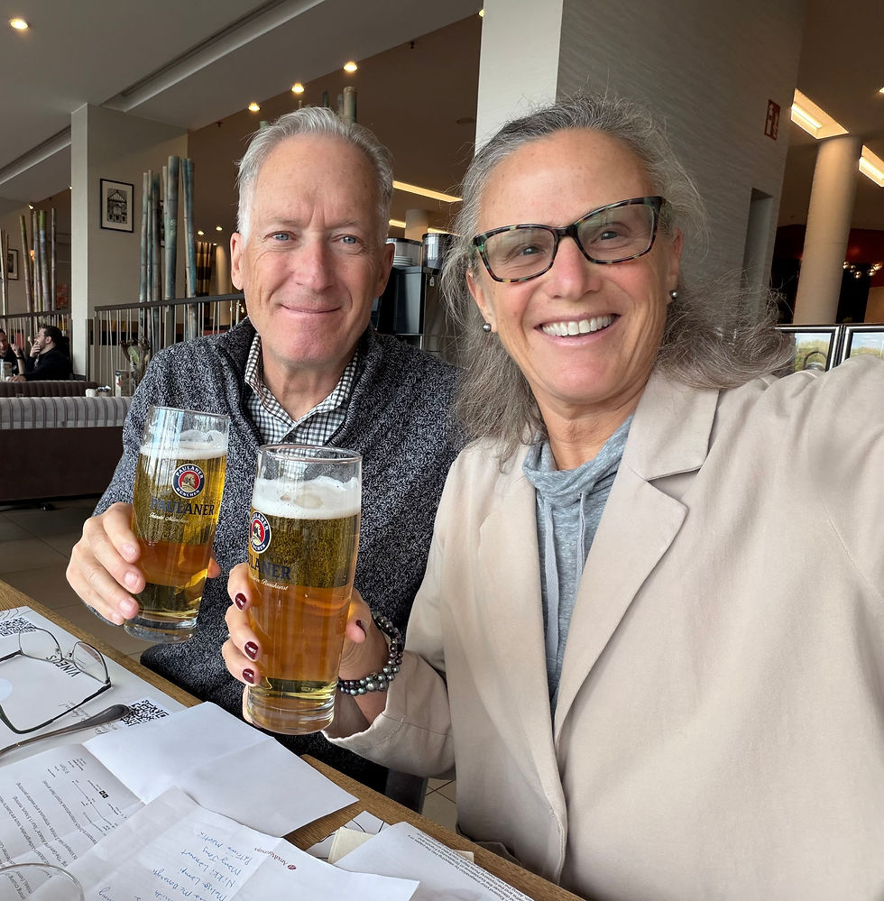

Comments