NATCHEZ TRACE CYCLING TRIP - April 2025
- Apr 22, 2025
- 26 min read

Thursday April 10, 2025
Jeff suggested that we head south to find a place to ride while awaiting Spring to fully arrive in Wisconsin. I turned to the Adventure Cycling Association and started researching southern bike routes. Originally, we planned to do a 22-day loop: Ride the Natchez Trace from Tupelo to Natchez, Mississtippi, and then continue to New Orleans, east to Gulf Shores, north through Alabama following the Underground Railroad cycling route and back to Tupelo. However, our riding partners, sister Sandra and b-in-law Matt bought a new Condo in St Paul and moved again. What we did not consider at the time of initial planning were two factors (1) Spring weather in the south could be tumultuous, and (2) we are not in shape to ride. We thought we’d worry about those things later.
Although we heard of the Natchez Trace, we really didn’t know a lot about it. I ordered a few books to do some research, and also asked ChatGPT to give me the history (which it took from Wikipedia):
“The Natchez Trace Parkway is a 444-mile scenic roadway that traverses Mississippi, Alabama, and Tennessee, following the historic Natchez Trace trail. This route has been used for over 10,000 years, initially by Native American tribes such as the Choctaw, Chickasaw, and Natchez, and later by European settlers, traders, and soldiers. The Parkway offers a tranquil drive through diverse landscapes, including forests, wetlands, and open fields, and is free from commercial traffic, making it ideal for leisurely travel. The original Natchez Trace was a vital corridor for commerce and communication, connecting the Mississippi River to the interior of the United States. It was used extensively by "Kaintucks," who transported goods downriver and returned north via the Trace. The route's importance declined with the advent of steamboats and railroads. In 1938, the Natchez Trace Parkway was established to preserve this historic path, with construction beginning in 1939 and completed in 2005.”
Besides much Native American and Civil War history, I was fascinated by the use of the Trace was by boatmen known as “Kaintucks,” primarily from Kentucky. These were farmer/merchants who floated their goods to market in flatboats or keelboats - traversing the Ohio, Cumberland, and Tennessee Rivers to the Mississippi. In Natchez or New Orleans, they’d sell their wares and the lumber from their boat and then begin the 20-30 day walk home. The Choctaw and Chickasaw Indians set up inns or “stands” along the Trace when the recognized the need for lodging and meals (both quite rustic).
We left home early in the morning on Thursday April 10 for the 10+ hour drive from Waunakee to Tupelo, and arrived there about 6:30pm (much longer and later for our companions from St Paul). It was an easy drive, and we marveled at the blooming red bud trees when we hit southern Illinois and azalea bushes through Tennessee and into Mississippi. I originally had the plan to shuttle our cars to New Orleans the following day (Friday) and drive a rental car back to Tupelo - but as I was driving through Kentucky today, I had a different thought: leave the cars in Tupelo, and then see how it goes and we can finagle a one way ride from wherever our destination ends up being. Gives us more flexibility as well as an option if we breakdown or otherwise crap out! It also gives us tomorrow to relax in Tupelo, visit Elvis’s birthplace, the Trace Visitor Center, a Civil War Battlefield, and gear up to begin our ride on Saturday!
Friday April 11, 2025
San and Matt arrived at the rental house shortly before midnight last night. We greeted them, then all went to bed. All exhausted from yesterday’s drives, it was after 8am before anyone was up and moving this morning.
Part of what delayed San and Matt last night was an issue with one of the tires on their car. As they skirted Memphis, they ran over some debris on the road and soon had “tire pressure” errors. They stopped at a gas station but the air hose didn’t work, so they used their bike tire pump to inflate the tire, and repeated that every ten or so miles for the 100+ miles! So, this morning, a trip to the tire shop was first on their agenda! It was a blessing that we were into Plan B and not scrambling to drop the cars in Louisiana!
Jeff and I walked the mile to Starbucks, and quickly learned that nobody walks in Tupelo! No sidewalks, but the drivers were courteous and respectful. From there, I saw that the Tupelo Battlefield monument was just 0.5 miles down the road, so we walked there and then made a loop back to the rental. Along the way, we saw the Trace very close to our rental (most of why I had picked it), but there is not access to it from the cross street! We will have to figure that out!
We picked up San and Matt at the tire shop. Worked out great that the tires need to be ordered and it will not be done until Friday - so they will keep her car there until then.
We headed to the Natchez Trace Visitors Center and got a little more information on the history of the Trace and valuable intel that should serve us well over the next week (like do not count on being able to find water!).
Matt researched BBQ places and found an awesome spot for lunch. Besides the great food, once again we were amazed by how friendly Southerners are!
From there, I persuaded the group to visit the compound that contains the house where Elvis was born. We did not pay the admission fee to get into the house and other exhibits, but walking the grounds and reading the tributes from people that knew Elvis as a young man were interesting. There were busloads of people there - it is quite the attraction. I am hoping to visit Graceland on our way home - complete the visit!
We next set our sights on securing a one-way rental to drive back to Tupelo after our bike trip. We had struck out online, so we visited the Enterprise, Budget and Hertz locations in person … where we struck out as well. Undeterred, I called Enterprise Customer Service and found an extremely helpful woman. She could not secure a one-way truck to be dropped off the same day, but said if I paid for a three-day rental, but dropped it off early, I would get the two days refunded. Glad to have that taken care of!
Back to the rental, we went through our gear for the week and tried to pare it down. Last time we did a self-supported ride, we did not carry a stove, cooking pot and food, but we need to for this trip as the Trace remains quite remote and our camping will be rustic!
We had a nice dinner, vegged out watching some TV. Ready and anxious to start riding tomorrow.

Saturday April 12, 2025
From a plaque in our rental:
The South … the place where:
1. Tea is sweet and accents are sweeter
2. Summer starts in April
3. Macaroni and Cheese is a vegetable
4. Front porches are wide and words are long
5. Pecan pie is a staple
6. Y’all is the only proper noun
7. Chicken is fried and biscuits come with gravy
8. Everything is Darlin’
9. Someone’s heart is always being blessed
10. Family roots run deep
A great night’s sleep at our rental and we were all up by 7 with last minute packing and lashing things to our BoBs. Due to probable lack of water where we will be camping tonight, I filled our 3L dromedary with water which really adds to the load!
We had breakfast then I drove our car to the airport parking lot (just over a mile away) and JT rode our tandem to pick me up. So far, the plan to leave the cars in Tupelo has worked well, with nothing major left out of the car, and nothing critical left behind!

We attached the BoB’s to the bikes and were on the road about 9am. It was a gorgeous morning, but temps were still in the 50’s so we added extra layers on top. We had to ride about 1.5 miles to get to an on-ramp for the Trace, but soon we were cruising. It really is a wonder to ride with no crossroads, no stop signs or traffic lights, and no way to get lost! However, traffic was heavier than we expected it to be, with lots of trucks with trailers and souped up ATV’s.
We were relieved to find a pull-out with a historical marker nearly every mile and we gladly took a quick stand-up break at each one! While the riding was easy today, when you have not put the time in on a bike, it is tough on your neck, wrists and butt.
We intentionally planned on a short day for our first day, and having left early, that means we arrived at our destination about noon with lots of time to kill. No one even suggested we ride further … it’d be another 40 miles to the next camp spot!
The first 20 miles today was predominantly flat, with a fewer ups and downs just before we ended. One was a 7% climb and we dropped down to our lowest gear! I had forgotten what a drag it was to pull BoB uphill … gravity sure has a hold on him!
We set up tents, snacked, napped and studied maps. It was good to be off the bikes. We’re at Witch Camp picnic area - it has about a dozen picnic tables, toilets and a drinking fountain that appears to be working (Ranger yesterday told us there would be no potable water here)! This is also the start of a horse trail, so it was fun to see the horses and riders ride up as we were lounging around during the afternoon.
Stats for today:
28.7 miles (Ave speed 13.6 mph)
3 hours riding
839 ft of climb

After a while, we decided to hike to Bynum Mounds, which we thought was just across the Trace, but was actually a mile down the road. Even though no one other than JT has good walking shoes, we walked there anyway! Yesterday at the Ranger Station we saw a video that depicted mound building. I’d never given it thought that those were built one basket of dirt at a time!
Back at camp, Jeff got out his old Coleman stove to start boiling water for dinner. Even though he tested it last week, it was having an issue. He thought he did not bring a critical part to the other stove, so I said I would go try to start a fire in the picnic grill. I gathered leaves, pine needles and twigs and lit them on fire. Meanwhile Jeff found the piece to the stove but had to dump some white gas from the canister. I said I could use some for my fire. I watched in shock as he poured the gas onto the fire and it ran up and into the canister. Being afraid the canister would explode, Jeff flung it down on the ground, causing a line of fire across the forest floor. Then I noticed his hand was on fire! He was able to blot it out before it ran up to his nylon shirtsleeve or down to his bare legs. Matt came with cold water and he and Sandra dug sand from under the picnic table and doused the fire. It all happened so fast. Jeff has some blisters, but is downplaying the whole thing. We are lucky we have a bathroom with cold water in the sink - he has been soaking it in the cold water. My mind cannot stop going to how bad that could have been.
We boiled water on the grill, and made our dinner pouches and played some cribbage and backgammon. By 7p it was cooling off - too early to go to bed, but the picnic table is not all that comfy either!
Sunday April 13, 2025
It got down to about 40 degrees last night - cold for tent sleeping! My 20+ year old North Face Cat’s Meow (rated for 20 degrees) was not doing a great job of keeping me warm so bit by bit I added all the clothes I had along, including my puffer jacket that was acting as my pillow. I did sleep ok, and Jeff woke up without any pain from his burns - a true blessing!
We were all slow getting up, because of the cold. I got out of the tent at 7 the first time, and it was already warming up outside. We used the auxiliary stove to heat water for breakfast and packed up. San and Matt with their heavier bike got a head start while we finished packing.
We were on the road by 9:46am, a little late for how long we’d hoped to ride today!
Our first stop was at the “Old Trace” rest stop at the 5-mile mark. We caught up to San and Matt there. By then it was hot and we were down to sleeveless tops, shorts, and no socks with our bike sandals! The Old Trace was really neat - quite a contrast to what we are riding on! There are small sections of it preserved, and I think it’s signed as a National Trail, but I am not sure (we haven’t seen their standard trail head signs on the highway).
We missed the frequency of the rest stops today, so we were biking about 5 miles before taking a quick stand-up break. We stopped at Line Creek - 20 miles in where we had a snack and a discussion about our 70-mile day (probably too ambitious). Decided to play it by ear, which I can do, but the planner in me needs to take a chill pill.
Next stop - Pigeon Roust, 30 miles in, 1:30pm. Another snack and laid around in the shade for 10 minutes. It was now above 80 degrees and we were feeling the heat and the lack of training!

The map showed a Convenience Store very close to the parkway within the next 10 miles. We made a plan to go there and hopefully buy something to give us the energy for 30 more miles. Alas, it’s Sunday in the South, and the store was closed! Discouraged and sick of trail mix and fig newtons, we pulled into Jeff Busby Campground a mile later. 3 pm and we decided to call it a day. It is a regular campground with flush toilets, good water, and lots of neighbors.
Stats for the day:
40.7 miles (ave speed 12.8 mph)
Five hours of riding, 970 feet of climb
We set up camp and I napped in the hot tent for about 20 minutes. I was exhausted! Jeff and Matt befriended the neighbor who gave us some fire starters and leant us his hammer … but did not offer us beer, much to our disappointment. We built a fire in the grill and heated our water for dinner over that, leaving our white gas to prepare breakfast.
After dinner we walked up the road to the overlook - the highest point in Mississippi (but under 1000 ft). There is a trail from the campground, but it was already dark in the woods and we all just have sandals (other than JT but that is by accident). Back to camp, we played 3 backgammon games before it was too dark. There were some mosquitoes but my herbal spray was keeping them at bay.
From here to Jackson, about 90 miles, there are no accommodation or campgrounds … which is why we wanted to do 70 miles today. We hope to get an earlier start, and find a good spot to “wild camp” at about mile 50 - stay tuned!!
Monday April 14, 2025
Much warmer night - I think in the 60’s but I tossed and turned a lot anyway, unable to get comfortable and lots of noises in camp - generators and car engines. We were up and out of the tent by 7am. We heated water for oatmeal and coffee and we were on the road just after 8:30am.
We left camp in shirt sleeves and shorts, a beautiful morning. In ten miles we arrived at French Camp, where we had been unable to secure a reservation in their charming B&B. We rode into the little village, they also have many replica buildings and other implements. San and Matt went into a cute coffee shop, but came back out when they discovered it was one barista and a long line of high schoolers ordering foo-foo drinks! There was another cyclist that had also made that determination, and we chatted with him for a bit. From Colorado, he is riding north from Natchez to Nashville. He gave us some good intel on what to come (carry water with us)!

We planned to resupply at the Walmart in Kosciusko, and in order to avoid backtracking we left the Trace north of town and rode on a busy highway with no shoulders for 1.5 miles and then back roads for another 4 miles. We rode by a sign that said “Site of Oprah’s First Home,” and we were on Winfrey Road actually. It was a tiny little hamlet called Buffalo. Not the best neighborhood, falling down houses and trailers, and of course, a dog ran out and gave chase to San and Matt for a bit. While riding the Trace was beginning to feel monotonous, we sure missed it during our little foray into town!
We stocked up on groceries, bought a bottle of wine, and a new little camp stove that attaches to a butane bottle. Then we rode the 1.5 miles to the Trace Welcome center and had a picnic in the shade. We went inside to use the toilets and fill our water bottles and dromedary so we will have water for tonight and tomorrow morning. There was a friendly older gentleman there who would have talked to us all afternoon, but we needed to press on.
Today was warm, I think about 85 degrees, with a steady breeze from the SW which kept us cool more than held us back. The surface of the road is not as smooth as our first day, but it lacks the frost heave bumps that all Northern roads seem to get! Traffic was much lighter today, mostly respectful cars giving us a wide berth - not so many trucks with trailers. Some motorcycles and a few RVs. It is really crazy to ride for so many days without Stop signs or turns to make. We have never ridden this long without making a wrong turn or getting lost!
We stopped at the Holly Hill wayside (no sign) and I noticed a loud rubbing sound coming from the back, and not just the disc brake which sometimes gets stuck. As progressed down the road, I noticed our tire was rubbing on the frame (no wonder it was so hard to pedal that last 5 miles). We had nearly tipped the bike over at our lunch stop, and that must have knocked the tire out of whack!?
We rode another 10 miles and decided the Myrick Creek wayside was a good place to spend the night. There is no toilet or potable water, but there are good tent sites not visible from the road and a picnic table and an exhibit about Beavers.
We’re at MM 155 (miles from Natchez) so we are gaining confidence that we will be there by Thursday afternoon, barring any major mechanical issues! We have booked a 2 bed 2 bath cabin for tomorrow night on the south side of the Ross R Barnett Reservoir and are looking forward to showers and beds!
We ate our picnic - ham and cheese charcuterie and the only wine they had a Walmart - a “low alcohol” wine from Italy!

After dinner, dusk was setting in and we set up our tents and hoped to not get busted by a ranger!
Stats for the day:
50 miles (11.4 mph average)
7:30 and were tucked in our tents for the night. The Trace seems relatively quiet, a few cars and the sounds of birds and insects.
Tuesday April 15, 2025
Everyone was up by 7, anxious to get the tents packed up before tourists / rangers started patrolling the parkway! It was a little freaky that just before I fell asleep last night a car came in, parked and a person got out (car door slammed). I laid there with my heart beating loud and fast, Jeff was already sleeping and apparently did not hear. After about a minute, the car door opened and shut again, and the car drove off. Other than that, it was a quiet location and I slept quite well.
We departed around 8:30am. The sky was overcast and we set out in long sleeves. Traffic was very light and it was a great morning to be riding. We saw several groups of riders out from the Jackson area for the day. The road surface wasn’t as good as earlier days … but we’ve ridden on much worse!
There were many pullouts with historical signs, so that made for many small breaks. The highlight was walking the boardwalk through the Cypress Swamp.

We came to the north end of the Ross Barnell Reservoir, and looked for a place to have lunch. There were lots of eroded unofficial pullout spots and we picked one of those to gingerly pull the bikes and trailers down. We sat in the shade under some big pines and ate lunch and snoozed.
One thing I have not been able to get a good photo of but I will try to describe: downed trees across the Parkway - some recent, some old, primarily pines. There are many large trees lining the parkway, and the pines here have a very shallow root base. When a tree falls across the parkway (looks like it happens with great frequency), someone chainsaws them into sections, then it looks like they use a bulldozer to clear the road. The chopped-up trunk will be on one side, and the top and branches on the other. The recently fallen trees still have sawdust and branches close to the road, and fresh mud tracks from the bulldozer. One even had car body parts mixed in - probably fell at night and the car crashed into it? Good reason to travel slowly on the parkway (few follow the 50-mph limit) and to not drive it at night!
At one of our last rest stops, I had to make a work-related phone call, so Matt and Sandra biked ahead. They skipped the “Overlook” stop, which is also where the 10-mile Chisha Foka Multi-use trail starts, which allows cyclists to avoid much of the Jackson metro area. I tried calling and texting her, then we just proceeded and made our way to the rental cabin for tonight on the south side of the Reservoir. We got into the room, then heard from San and they made their way to us along an alternate route.
The cabin in perfect - 2 bedrooms and 2 bathrooms, a nicely outfitted kitchen, and a nice wide porch for watching the comings and goings from the other cabins as well as drying our hand washed laundry! First thing I did was drink two glasses water - we had run out of water today and none of the rest stops had potable water. San and Matt used their water filter and our steri-pen and filled their bottles from the sink at the one rest stop we had today that had plumbing. So far so good for them!
The shower was so amazing. I do not recall ever being so grimy, at least in my recent history! We arrived about 2:30p, and by 4:30p, we made our way to Shuckers Oyster bar across the parking lot. We had beers, crab claws, fried onions and fried pickles and followed up with more beer and entrees: Po Boys, BBQ pork, pizza!

After dinner, San and I walked along the dike to the Kroger’s grocery store (about 1.5 miles), then detoured on the way back to a liquor store to buy bourbon and small boxes of wine. It was pushing dark when we arrived back at the cabin. We enjoyed the bourbon while San and Matt played cribbage and JT and I played backgammon. I was anxious to get to that comfy bed!!
Stats for the day:
42.56 miles (13.5 mph average)
378 ft elevation
4 hours ride time
Wednesday April 16, 2025
I woke up about 7am, but I could have slept until noon. We forgot to “tick check” JT after his shower last night (we pulled 2 ticks off him at Cypress swamp yesterday) and there were two more ticks on him today - one engorged already. We think they are “Lone Star” ticks – which don’t transmit Lyme, but according to Google, there is potential for other diseases. Matt has had a lot of history with tick bites and suggested Jeff take a dose of Doxycycline just in case. Jeff reached his doctor who called in a prescription to the Walgreens that is just over a mile away. Good timing and place for a pharmacy need!
We had breakfast and packed up. Walgreens pharmacy did not open until 9, so we lounged around on the porch and headed out around 9:30am. We only had to wait for 10 minutes for the prescription to be filled at Walgreens, not too bad!!
It did not look too hard to pick up the Chisha Foka Multi-use trail from there, but it was! We had to take a ramp up to the Trace and then exit on the other side - I could see it on Google maps, but it was tough to execute. When we got to the trail, there was a “Trail Closed” sign, and an older guy leaning against a truck. I tried to communicate with him, but it was like one of us was speaking a foreign language (and it was not me)! He said it was okay for us to ride on the trail as there was no heavy equipment in use. He was wrong, we did encounter a big piece of equipment working on the shoulders of the trails, but the three guys working on it were friendly and waved us around. We got off the bikes and walked around. We rode about another mile and the trail went down to an intersection where it looked a lot like where we had started this ordeal, but a check with Google maps, I saw that it was not. All the cloverleafs really messed with our sense of direction!
We crossed the intersection and proceeded on the trail. Some sections were newly paved, and there were a few more “Trail Closed” barricades that “perhaps” I got off the bike and moved to the side a little bit. At one barricade, a woman came down the trail towards us and reported it was paved yesterday and no one was working on it now. We proceeded and then came to a barricade that said $5000 fine and six-month jail sentence for proceeding. Jeff and I were nonplussed, but Matt was not going to proceed. We did not have a lot of other options. The Trace was right there but without a ramp to get up to it, and we were in the Jackson metro area and traffic was nuts! Jeff and I proceeded around the barricade, and it was a nice new trail with no workers. We got to a point where we could have crossed over to the Trace, but the southbound lane was under construction and the pavement had been stripped - it would have been a horrible riding surface. I called San and told them the coast was clear and they should ride up the path to meet us and they did. We opted to stay on the trail for the five remaining miles. Some was new pavement; some needed repair! At the end, the trail abruptly ended in a meadow and we had to push our rigs uphill through tall grass to rejoin the Trace. Very odd, but I had read about it, so I knew what to expect!
The traffic was heavy until we were way past another suburb called Clinton. The day was hot, and we were an unsettled group with the odd morning we’d had! I am suffering from the reaction to “No See Um” bites from a few days ago, and a reaction to Poison Ivy on one ankle and foot. I am taking more Benadryl than is probably okay, and slathering on cortisol crème. I know my being out of sorts can make me surly. We are also on day 5, and this many days of riding and encountering the unknown if an adventure like this can wear on you! But still we persisted, taking breaks about every 5 miles or so.
We arrived at Rocky Springs campsite just after 4pm, where there are flush toilets, but no potable water. We are trying our luck with water out of the sink, running it through Matt’s filter and bringing it to a rapid boil. We have our boxed wine and the other half of our Woodford Reserved Double Oaked bourbon to drink with dinner - who needs fresh water!?
We had dinner and fun conversation. Good to come together after such a day. Everyone is tired and we were in our respective tents around 8pm. Quiet campground, and it is away off the Trace so not much road noise.
Stats for the day:
53.5 miles (ave 13mph)
4 hours ride time
1386 ft climb
Thursday April 17, 2025
Another cold night, ended up with my puffy jacket on inside my sleeping bag and I was comfortable but it was tough to pack up my sleeping bag and get out of the tent! The sun was out and we figured it would heat up fast again (it did). Boiled some water for tea and ate breakfast out of our snack bag. We were packed and on the road at 9am - seeking fresh water, probably in Port Gibson, 15 miles down the road.
It was an easy 15 miles with one short stand-up at an Indian mound. We did not have a cell signal last night, but I had one there so booked two hotel rooms in Natchez for tonight. We also stopped at the “Sunken Trace” which was really cool.
We detoured off the Trace to Port Gibson, in search of water and a cafe. Our map said it was an “historic town” but it sure did not match any of our expectations! We rode 1 mile along a highway that was not too busy, but was lined with falling apart trailers and homes that were clearly occupied - so sad to see that kind of poverty.
There was a hardware store at the corner, where Matt went in to buy a nut and bolt for their BoB fender. We rode by a beautiful Court House, through a mostly boarded up business district except for a bank and a barber shop that was closed. As we rode out of town, there were a few B&Bs in restored Victorian era houses and it looked a bit more prosperous. As we were riding out of that end of town to get back on the Trace, I turned around to read a sign that said: “Welcome to Port Gibson, Too Beautiful to Burn.” We figured it was referring to Civil War action?! There was a gas station just before we joined the Trace and we stopped there to buy bottles of water and snacks. Jeff and I sat on the dirty sidewalk in front of our bike and shared a Snickers Bar and a Root Beer; it was just like old times for us!

Back on the Trace, we stopped North Fork Coles Creek for lunch, then continued to Mount Locust where there was a ranger station and a historic house. The ranger tried to freak us out about snakes and limbs falling from trees. I tried to pass on some feedback that they should tell north bound cyclists about the trail work being done around Jackson, and that they could have posted detours along with their threatening “do not proceed” signs, but he did not appear to be interested in my ideas. The historic house has recently been found to be structurally unstable, so no one is allowed inside - we just perused the photo book instead.
15 miles until Natchez, we split up as JT and I were going directly to the Enterprise Rental Car place and Matt wanted to check out Emerald Mound. The last miles clicked away fast, with rolling hills - some long climbs, and then really fun downhills.
As soon as we were off the Parkway, traffic was stressful and chaotic. We were just 1 mile from Enterprise, but it required us riding a ramp up to a busy highway, then crossing three lanes of traffic for a left exit.
We had reserved a one way rental from Baton Rouge to Tupelo, but getting there would have meant an additional 110 miles of riding, so my plan had been too ambitious for the kind of shape we were in. I tried to change the pickup location through the app, but was unsuccessful. My plan B was to pick up a car, drive it to Baton Rouge to get the truck, then drive both back to Natchez to load up the bikes and drive to Tupelo - lots of moving pieces! I went into Enterprise and tried my best charm to ask for a truck or a large van and she said they had nothing available. As we worked through the transaction for the car, she said “just a minute” and walked into a back office. She came back and said “we’ve just had a cancellation and I can give you a truck!” What great luck! Still frazzled from the ride on the highway, we loaded our bike and BoB into the truck bed and drove to meet San and Matt who were already at the hotel.
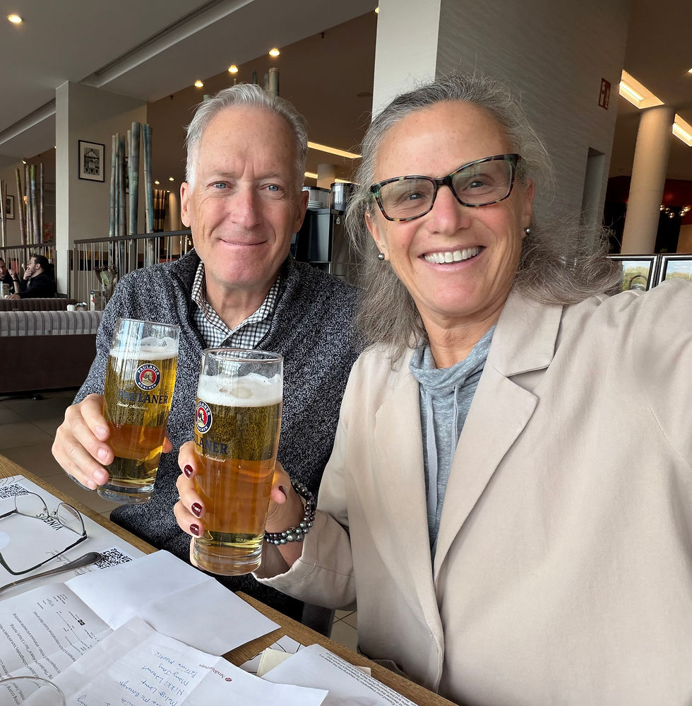
I had booked us two rooms at the Natchez Grand hotel on the riverfront. We had three cart loads of miscellaneous things to get up to our rooms including our bike (in two pieces) and our two BoB bags. We showered and headed out in search of dinner. Our first choice was closed for renovations so we headed up the street a little further to the Rolling River. There was had a good Southern meal: fried broccoli, fried catfish, mustard greens, fried chicken, and ribs. After dinner we stopped at the corner bar where San and Matt drank a pitcher of beer and JT and I drank generous pours of bourbon. Fun night celebrating our successful adventure!
Stats
58.85 miles. (275 miles total)
1608 ft elevation (6095 total)
Friday April 18 – Sunday April 20, 2025
Great night’s sleep and we were awake by 6:30am. We dressed and went out to walk along the Mississippi, and found San and Matt out there too. We walked for about 30 minutes, then back to the hotel for breakfast: sausage, scrambled eggs, biscuits and gravy, fruit, and yogurt.

Then we loaded the contents of our rooms onto two carts, and went out to load the truck bed. Everything fit very well! Soon we were on our way for the 5+ hour drive back to Tupelo. The Google Maps route took us on a 4-lane highway to outside Port Gibson, then on the Trace to outside of Jackson. There were lots of cyclists out today - none loaded with gear so they were out for day rides or were otherwise supported with someone transporting their gear. It was amazing how fast the mile markers fly by at 50 mph!
From Jackson we traveled on I-55 for about an hour (towards Memphis, our destination for tonight). Then we headed east again and rejoined the Trace again at MM 205.
Final observations of the ride:
- We are proud of the way our gang adapted to mileage expectations, uncomfortable conditions such as bugs, tick bites and pharmacy run, poison ivy, lack of fresh water availability, rustic camping, leave-no-trace toileting in the woods, and camp stove issues!
- The only thing we did not bring was the charging cord for the little Garmin. If we knew how scarce the drinking water would be, we might have brought along our second dromedary, but that is a lot of weight when they are full.
- Our charging block (also heavy) worked well - through three nights of camping we were able to use it to charge our phones, the batteries for the bike’s electronic shifting, my Apple watch and my helmet - with juice left over!
- Bug spray worked for the no-see-ums and the few mosquitoes we had encountered.
- We could have been more diligent with our sunscreen.
- The poison ivy warnings were no joke!
- The weather could not have been more prefect. Mississippi had strong storms the week before our ride, and more are expected next week. Riding and/or camping in a storm would have maybe been a deal breaker with the way the trees seem to fall!
- For the most part, the cars were terrific and traffic was light. We had two scary moments, one when a truck passing us nearly ran an oncoming car off the road, and another when a truck was passing an oncoming car - unsettling to see that coming towards you with not much shoulder on either side. There were a few cars including a state trooper who felt the need to honk at us, which I think is just ignorance as they do not realize that it startles cyclists.
- The surface of the parkway was mostly smooth, and it is unreal to go for hundreds of miles with no stop signs or turns to pay attention to!
We arrived in Tupelo, and dropped San and Matt at the Tupelo Tire where they had kept her car for the week after putting on 4 new tires. We drove the truck to the airport parking lot, and were happy to see our SUV there, pollen covered, but otherwise just fine. San and Matt drove up and we sorted gear into the appropriate vehicles. San and Matt decided to head home – a storm is due to blow through the Midwest, and they did not want to drive through that with their bike on the roof. We drove the truck and our SUV to the Enterprise lot – turned out to be a great deal for us at $143 ($50 of that was the one-way drop fee). We picked up lunch and drove the 90 minutes to Memphis.
We had booked two nights at the Marriott Renaissance hotel downtown – valet parking and a great location. We got settled and headed down to Beale Street – crazy already at 5pm on a Friday night. We listened to some music, had BBQ for dinner and a few beers, but mostly we people watched. Words can’t really describe it …

On Saturday we slept late, ate breakfast, then headed out to tour Graceland. We did the self-guided audio-tour, and I enjoyed it. One thing that surprised me is the house itself is not that big! The decorations are over the top, just to show that Elvis’ creativity did not stop with music.

Back to the hotel, we parked the car and rested a bit, then set out to walk to the National Civil Rights Museum at the Lorraine Hotel, the spot where MLK was assassinated in 1968. It is a sad and moving testament to the horrible racism and that plagued our country, even more so after slavery was abolished.
We walked back and decided to check out Beale Street, where we came upon a courtyard with 4 guys playing – very entertaining. We spent 30 minutes there and had a beer, but had to move on as we had 6pm dinner reservations. Nice dinner with Paso Robles wine (heading there next week). After dinner we decided to just head up and play some backgammon and not go back out to the craziness of Beale Street.
Sunday, we drove the 10 hours back to Waunakee – listened to the book “James,” which is a narrative from Jim, the slave in the Huckleberry Finn stories. It was especially poignant since we were driving through Missouri and had been along the Mississippi River for portions of this trip.


Comments